Overview
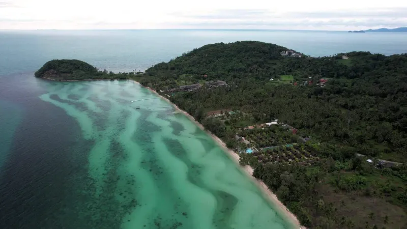
Bang Makham Beach is a ~2 km stretch of coastline on the west coast of Koh Samui, running along the island’s Ring Road between Laem Yai Cape to the north and Nathon, Samui’s main port town, to the south. It is one of the least visited shorelines on the island: not because it lacks appeal, but because the coast road runs directly along the water’s edge for its entire length, leaving no room for the resorts and beach clubs that define Chaweng or Bophut.
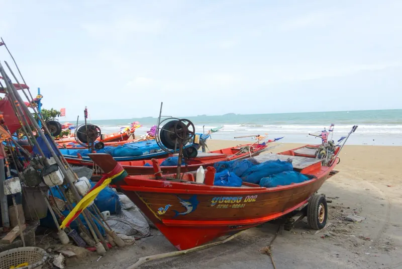
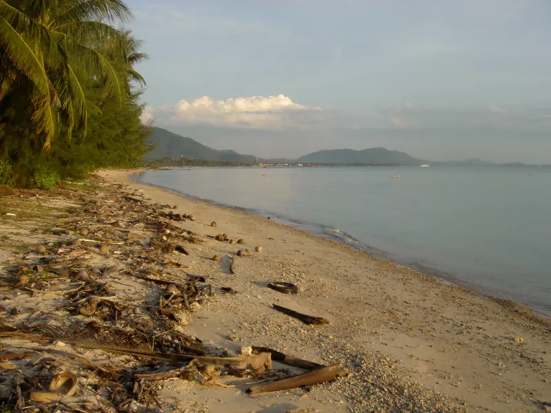
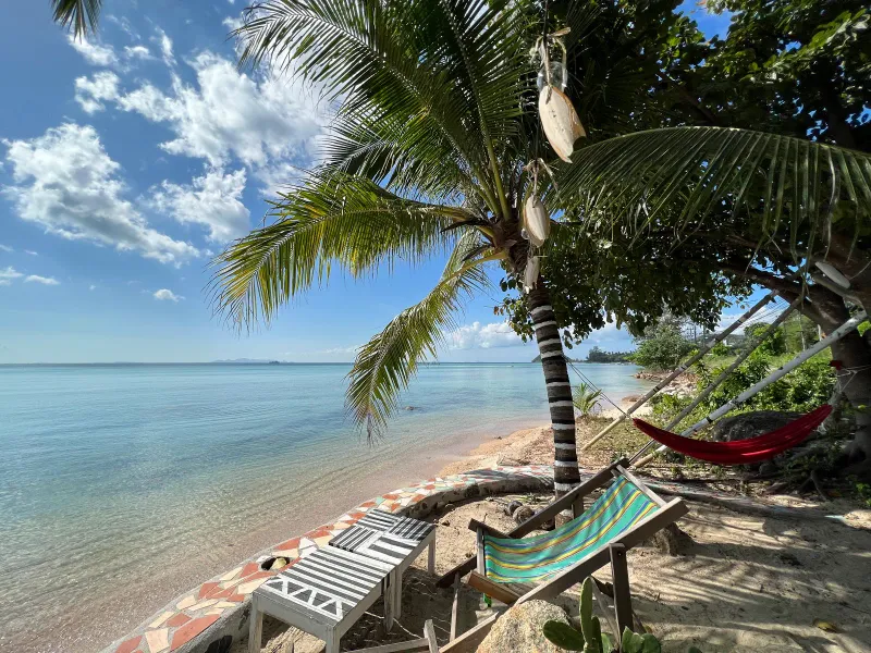
What Bang Makham offers instead is authenticity. This is a working fishing shore, dotted with anchored longtail boats, fishermen’s houses, and small family-run cafes rather than sunbeds and jet-ski touts. From several points along the road, the view opens onto the limestone islands of Ang Thong National Marine Park floating on the horizon, along with the southern coastline of Nathon and Tong Yang Bay.
Because there are no hotels directly on the sand, Bang Makham sees a fraction of the visitors that pass through Samui’s east coast beaches. Locals fish here, expats living nearby stop for a sunset drink at one of the small roadside bars, and travelers who happen to drive the Ring Road between the airport and Nathon Pier are often the only tourists to notice it at all.
History: A Working Fishing Shore
Like much of Koh Samui’s west coast, Bang Makham’s history is tied to the coconut and fishing economies that sustained the island long before tourism arrived. The name “Bang Makham” references the tamarind trees (makham in Thai) that once grew along this stretch of shoreline: a naming pattern common across coastal Thai villages, where local vegetation gave neighborhoods their identity.
For generations, the community here made its living from the sea. Longtail boats went out from this shore daily, and the shallow nearshore waters (rich in crabs, small crayfish, and shrimp) supplemented the catch for household tables. Nathon, immediately to the south, grew into Samui’s administrative and commercial heart because of its natural harbor; Bang Makham, just outside town, stayed residential and agricultural. Koh Samui itself, the Gulf of Thailand’s third-largest island, only shifted from a coconut-export economy to a tourism-driven one from the 1980s onward: a transition that reached the east coast long before it touched quiet stretches like this one.
Why it never developed
When large-scale tourism reshaped Chaweng and Lamai from the 1980s onward, Bang Makham was structurally protected from the same fate: the island’s Ring Road runs along the water’s edge for the beach’s entire length, leaving no buildable strip of land between road and sea for hotels. Combined with a beach that only fully appears at low tide, Bang Makham was simply unsuited to the sun-lounger tourism model that transformed other coasts. What survived instead is a shoreline of fishermen’s houses, a handful of hillside rental homes, and a slow, local rhythm of life that has barely changed in decades.
The Beach: Tides and Sand
Bang Makham behaves differently depending on the tide, which is the single most important thing to understand before visiting.
At high tide
At high tide, Bang Makham narrows to a thin strip of shallow, knee-deep water running along the Ring Road. It is calm and warm enough for young children to wade and explore, and the transparency of the water close to shore makes it easy to spot small crabs and shellfish. This is not a swimming beach in the conventional sense: the water rarely gets deep enough for proper swimming near the road.
At low tide
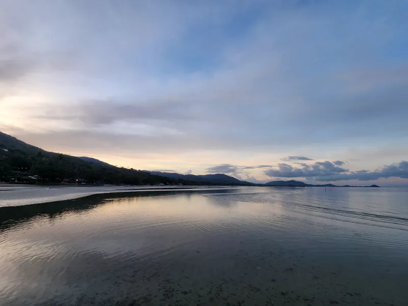
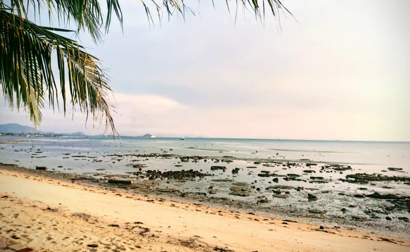
As the tide retreats, Bang Makham reveals a genuinely spacious sandy expanse: walkers can cross several dozen meters of exposed seabed to reach the anchored fishing boats. The sand close to shore is a mix of fine silt, shell rock, and live seashells; farther out, it turns fine, light-colored, and cleaner underfoot. Locals describe the texture near the tideline as “sticky,” closer to fine semolina than the powder-soft sand of Chaweng or Bophut.
An honest caveat
Bang Makham is not maintained by resort staff the way beaches fronting five-star properties are. Because no single business is responsible for cleaning it, waste and debris (driftwood, plastic, and the occasional bottle) can accumulate, particularly after storms. Visitors expecting a manicured tourist beach should adjust expectations; this is a working coastal community first, a beach destination second.
Ang Thong Marine Park Views
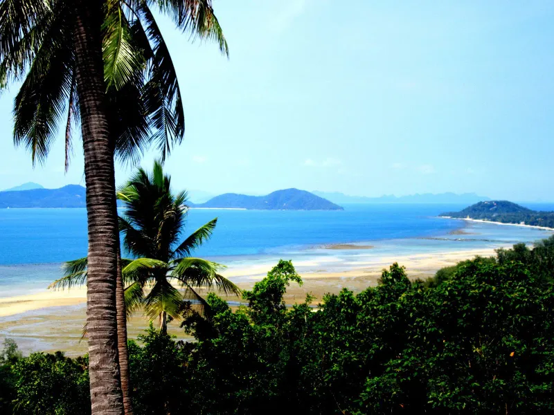
The single best reason to slow down along this stretch of the Ring Road is the view. On a clear day, the silhouettes of Ang Thong National Marine Park (a cluster of roughly 42 limestone islands scattered across the Gulf of Thailand) rise from the horizon to the northwest. The angle from Bang Makham also takes in the southern coastline of Nathon and the curve of Tong Yang Bay, making it one of the better unofficial viewpoints for the marine park anywhere on the island.
Bang Makham itself is not a departure point for Ang Thong boat tours (those leave from piers closer to Nathon or from operators based in Bophut and Maenam) but the beach makes an excellent spot to appreciate the park’s dramatic scenery without booking a trip. For visitors who do want to get closer, full-day Ang Thong boat tours with kayaking, snorkeling, and a hike to the Emerald Lake viewpoint on Koh Mae Ko typically run 1,500-2,500 THB (~43-71 USD) per person, departing most mornings from the mainland-facing side of the island. Ang Thong National Marine Park is officially protected by Thailand’s Department of National Parks, which covers 42 islands across roughly 100 square kilometers of the Gulf of Thailand.
Activities and Water Sports
Bang Makham is not built for adrenaline or organized water sports the way Chaweng or Bophut are, but a small number of activities are genuinely worth trying.
- Kayaking and catamaran sailing: A handful of local operators along the beach rent sail catamarans and kayaks, mostly to residents and long-term visitors rather than day-trippers. Expect informal, cash-based rentals rather than a fixed price board.
- Kiteboarding: A kiteboarding school operates nearby in Nathon, running from May to October when southwest winds are most consistent on this side of the island.
- Fishing trips: Local fishermen occasionally take visitors out on their longtail boats for a few hours of line fishing: ask at the small cafes along the road, as these trips are arranged informally rather than booked online.
- Low-tide beachcombing: When the tide is out, walking across the exposed sand to the anchored boats and exploring tidepools for crabs and shellfish is the beach’s simplest and most reliable activity, especially for children.
- Photography: The combination of longtail boats, Ang Thong’s silhouette, and Nathon’s waterfront skyline makes this one of the more photogenic stretches of the west coast, particularly in the late afternoon light.
Where to Eat and Drink
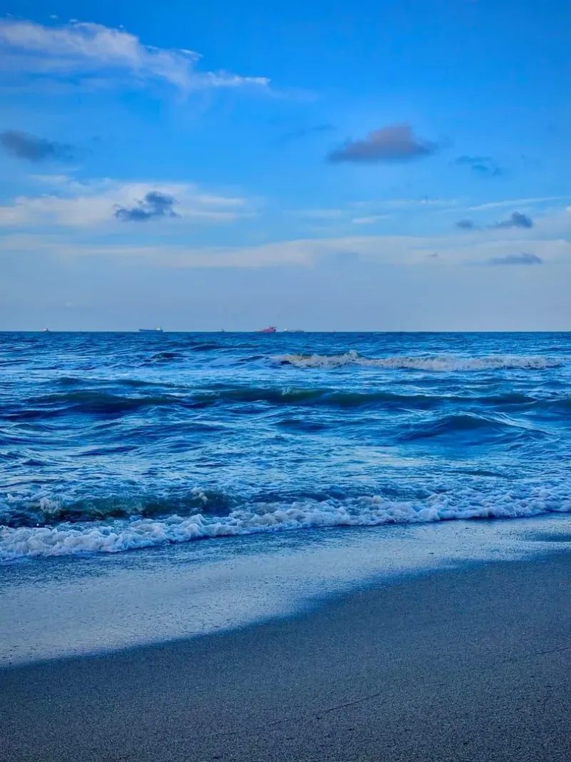
Because no resorts occupy this stretch, dining at Bang Makham is entirely local and small-scale, which is also what makes it interesting.
Roadside cafes and restaurants
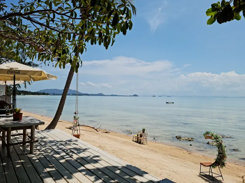
Along the Ring Road that hugs the beach, a mix of Thai, Chinese, and European (Italian and German) cafes and restaurants cater mostly to residents and long-term expats rather than tour buses. Menus lean toward simple Thai home cooking, fresh seafood, and Western comfort food for the area’s sizeable expat community. Prices are noticeably lower than on the east coast: a plate of pad thai or fried rice typically runs 60-100 THB (~1.50-3 USD), and a whole grilled fish dinner is commonly 150-350 THB (~4.50-10 USD).
The hidden beach bars
What Bang Makham lacks in beach clubs, it makes up for with a scattering of genuinely hidden beach bars: small, easy-to-miss operations run out of a fisherman’s front yard or a converted roadside shack, usually with a handful of plastic chairs facing the water and Ang Thong’s islands beyond. These places rarely have signage worth noticing from a moving car, open at owners’ discretion in the late afternoon, and serve cold Chang or Singha beer for around 60-90 THB (~1.50-2.50 USD). They are not destinations to plan an evening around. They are places to stumble onto by slowing down and looking.
The Bang Makham Walking Street
A weekly “Walking Street” fair sets up near Bang Makham Pier, offering local street food, Thai desserts, and produce in a small-town atmosphere far removed from the market crowds of Bophut’s Friday night or Maenam’s Thursday walking streets.
Nathon town dining
For a wider range of options, Nathon town (a few minutes south) has considerably more choice: Thai street food stalls, seafood restaurants, bakeries, and shops selling everything from fresh produce to hardware. Since Nathon functions as the island’s administrative capital, it also has the best concentration of ATMs, banks, and pharmacies on this side of Samui.
Nearby Attractions
Under 10 minutes
- Nathon Town: Samui’s main port and administrative center, immediately south. Ferry connections to Surat Thani and Don Sak on the mainland, banks, markets, a post office, and the widest choice of shops on the west coast.
- Laem Yai Cape: The northern boundary of Bang Makham, a rocky headland with sea views back toward Nathon.
Under 20-25 minutes
- Lipa Noi Beach: A quieter, sandier west coast beach roughly 10-15 minutes south of Nathon, known for calm swimming and sunset views toward Ang Thong.
- Taling Ngam Beach: A southwest coast beach with its own Ang Thong panorama, anchored by the InterContinental Koh Samui Resort, about 20 minutes south.
- Maenam Beach: On the north coast beyond Bang Po, roughly 20-25 minutes by car, offering a livelier but still relaxed alternative with its own Thursday night market.
- Ang Thong National Marine Park boat tours: While Bang Makham offers the view for free, full-day tours to the park itself typically depart from piers near Nathon or from Bophut and Maenam. See the Ang Thong Emerald Lake day trip for what a visit involves.
Where to Stay
There are no hotels directly on Bang Makham Beach itself: the Ring Road running along the water’s edge leaves no room for beachfront development. Accommodation options instead sit on the hillside just inland, or in Nathon town a few minutes south.
| Category | Average Price | Notes |
|---|---|---|
| Budget | 525-1,225 THB (~15-35 USD)/night | Simple guesthouses and rental rooms in Nathon town |
| Mid-range | 1,400-2,800 THB (~40-80 USD)/night | Hillside houses and small rental villas overlooking Bang Makham and Ang Thong |
| Long-term rentals | 8,000-25,000 THB/month (~229-714 USD) | Popular with expats who want sea views without east coast prices |
Most visitors who want to experience Bang Makham stay either in Nathon town for convenience and ferry access, or in nearby Lipa Noi, which has more conventional beachfront resorts a short drive south.
Getting There
From Samui Airport (USM)
Bang Makham sits on the opposite side of the island from the airport, roughly 20-22 km away, about 30-35 minutes by car via the Ring Road (Route 4169).
- Airport taxi: Typically 500-600 THB (~14-17 USD), prepaid at the airport counter.
- Note: Grab (ride-hailing app) cannot pick up inside the airport terminal but works for trips originating elsewhere on the island.
From Nathon Pier
If you arrive by ferry from Surat Thani or Don Sak on the mainland, Bang Makham begins almost immediately: the beach’s southern end borders Nathon town, so it is within a 5-10 minute walk or a very short drive north along the Ring Road from the pier.
From other beaches
- From Lipa Noi: About 10-15 minutes north via Nathon (~150-200 THB by taxi).
- From Taling Ngam: About 20 minutes north (~250-350 THB by taxi).
- From Maenam: About 20-25 minutes south along the coast road (~250-350 THB by taxi).
- From Chaweng: About 40-45 minutes across the island (~450-600 THB by taxi).
Getting around
The Ring Road runs directly alongside Bang Makham, so a scooter (200-300 THB/day, ~6-9 USD) or car rental (1,200-1,800 THB/day, ~36-54 USD) is the easiest way to explore the full stretch and stop wherever the view or a roadside bar catches your eye. Songthaews serving Nathon also pass along this road, though they do not make dedicated stops for the beach itself: flag one down and ask to be let off along Bang Makham.
Best Time to Visit
| Season | Months | Conditions | Rating |
|---|---|---|---|
| Peak / Dry | Dec-Feb | Clear skies, best visibility for Ang Thong’s islands | ★★★★★ |
| Hot | Mar-May | Hotter (~35 degrees Celsius+), generally dry | ★★★★ |
| Inter-monsoon | Jun-Aug | Kiteboarding season begins; mixed weather | ★★★★ |
| Monsoon | Sep-mid-Nov | Heavier rain, choppier seas, reduced visibility of the marine park | ★★★ |
Tide timing matters more than season
Because Bang Makham only fully becomes a walkable beach at low tide, checking a local tide table before visiting matters more here than at most Samui beaches. Aim for a low-tide window in the late afternoon for the best combination of exposed sand and golden light over Ang Thong. The kiteboarding season in nearby Nathon (May to October) roughly overlaps with the inter-monsoon and early monsoon months, when southwest winds pick up.
Practical Tips
- Footwear: Water shoes or sandals are worth wearing on the exposed low-tide sand: shell rock and scattered debris can make bare feet uncomfortable.
- Cash: Most roadside cafes, fishermen offering boat trips, and hidden beach bars are cash-only. ATMs are readily available a few minutes south in Nathon.
- Cleanliness: Unlike resort-fronted beaches, Bang Makham is not regularly cleaned. Expect some driftwood, plastic, and debris, especially after monsoon storms.
- Swimming: This is not a swimming beach at low tide, and only shallow wading at high tide. For proper swimming, head to Lipa Noi or Taling Ngam further south.
- Traffic: The Ring Road here carries through-traffic between the airport, Nathon, and the west coast, so take care crossing or parking along the shoulder.
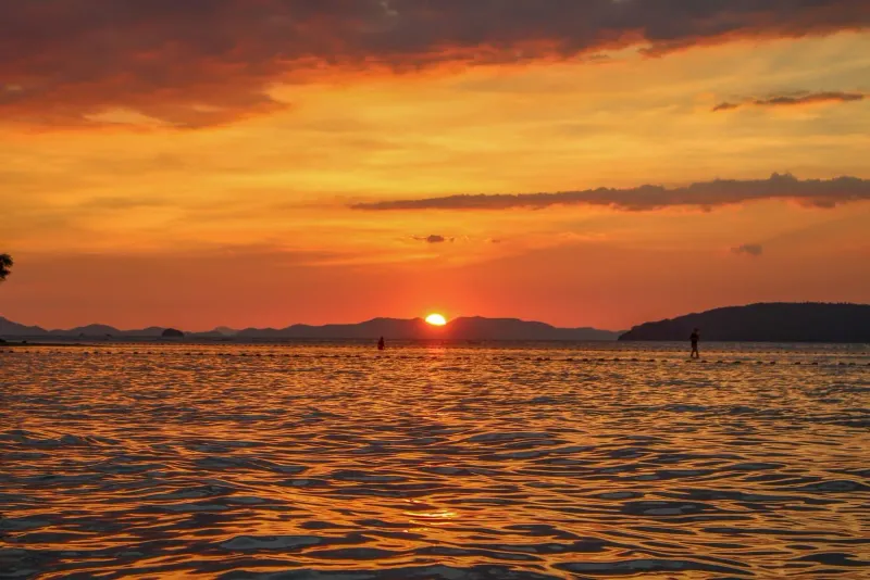
- Sunset timing: The west-facing orientation makes Bang Makham one of the better sunset spots on the island, with Ang Thong’s islands silhouetted against the color.
Who Is Bang Makham Best For?
| Traveler Type | Fit | Why |
|---|---|---|
| Independent explorers | ★★★★★ | Genuinely undiscovered stretch most tourists drive past without noticing |
| Photographers | ★★★★★ | Fishing boats, Ang Thong silhouette, and sunset light in one frame |
| Long-term expats | ★★★★ | Low-key bars, affordable dining, and a real fishing-village atmosphere |
| Families with young kids | ★★★ | Safe shallow wading at high tide, but not a proper swimming beach |
| Swimmers | ★★ | Better suited to nearby Lipa Noi or Taling Ngam for actual swimming |
| Party seekers | ★ | No nightlife whatsoever: Chaweng is the opposite end of the island |
| Ferry travelers | ★★★★★ | The closest beach walk to Nathon Pier while waiting for a ferry |
FAQ
Where is Bang Makham Beach on Koh Samui?
Bang Makham Beach is on the west coast of Koh Samui, running for ~2 km along the Ring Road between Laem Yai Cape to the north and Nathon town, the island’s main port, to the south. It sits roughly 20-22 km from Samui International Airport, about 30-35 minutes by car via the Ring Road.
Can you swim at Bang Makham Beach?
Not in the conventional sense. At high tide, Bang Makham has only shallow, knee-deep water suitable for wading, and at low tide the sea retreats far from the road, leaving exposed sand rather than swimmable water. For proper swimming, nearby Lipa Noi or Taling Ngam beaches further south are better choices.
Is Bang Makham good for families?
It suits families looking for a quiet, low-key stop rather than a full beach day. Shallow high-tide water is safe for young children to wade and explore crabs and shellfish, but there are no lifeguards, sunbeds, or facilities. Families wanting a proper swimming beach should head to Lipa Noi instead.
Why does Bang Makham have views of Ang Thong National Marine Park?
Bang Makham faces northwest across open water toward Ang Thong National Marine Park’s cluster of roughly 42 limestone islands. On clear days, especially in the December-February dry season, the islands’ silhouettes are visible from several points along the beach, making it a free, unofficial viewpoint for the park.
Are there hidden beach bars at Bang Makham?
Yes: a scattering of small, informal bars run out of fishermen’s front yards or roadside shacks along the beach, usually just plastic chairs facing the water. They have little to no signage, open at the owner’s discretion in the late afternoon, and serve cold beer for around 60-90 THB (~1.50-2.50 USD). They reward slowing down rather than searching online.
How do I get to Bang Makham Beach from Nathon Pier?
Bang Makham begins almost immediately north of Nathon Pier: within a 5-10 minute walk or a short drive along the Ring Road. It is one of the closest beaches to the ferry terminal for travelers arriving from Surat Thani or Don Sak on the mainland.
About the author

Migues Ferfumoz
Writer, Koh Samui resident since 2019
Freelance writer and Koh Samui resident since 2019. Migues covers local culture, food, and the best off-the-beaten-path destinations on the island.
Articles by Migues →