Contents
Overview
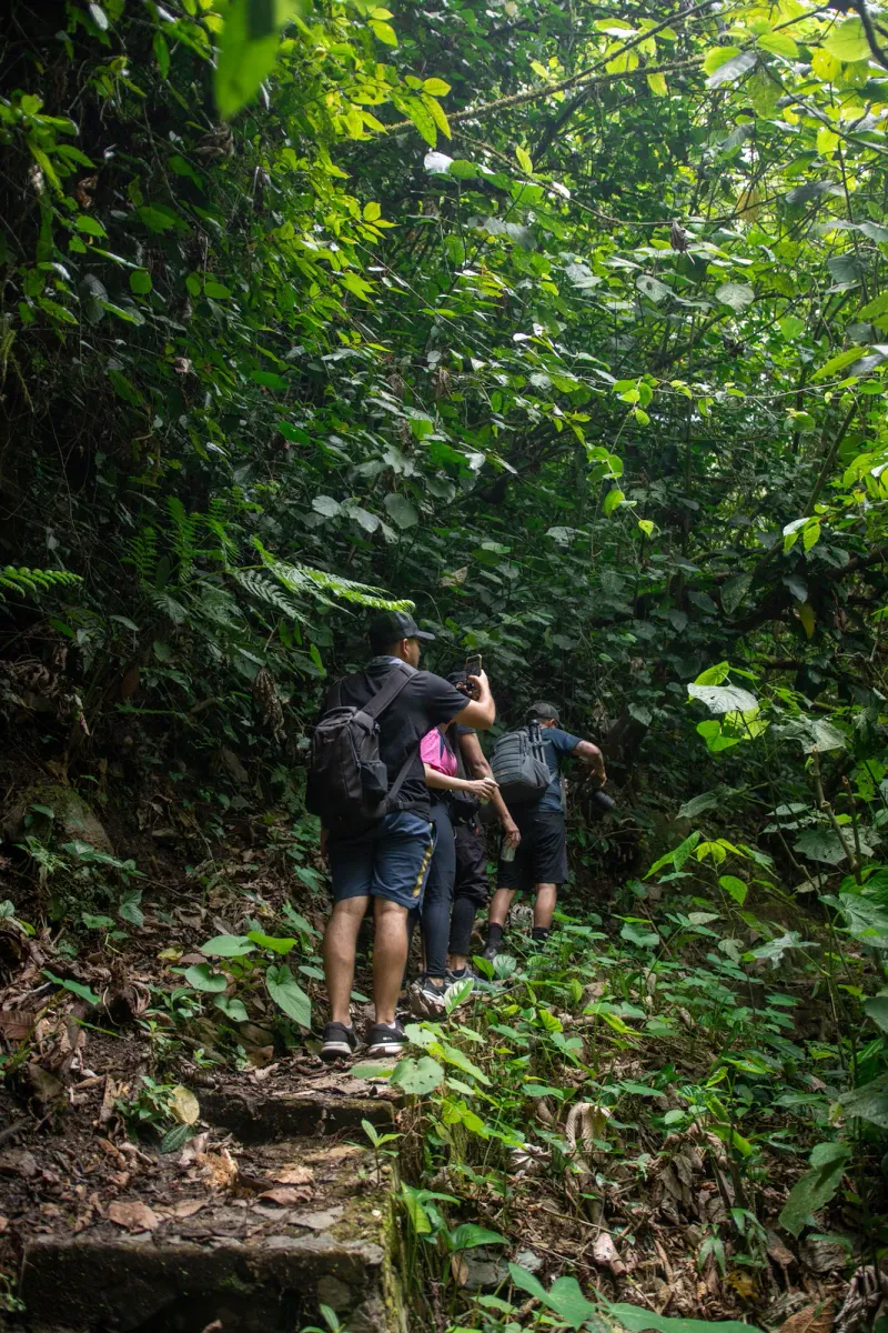
The Hog Trail is one of Koh Samui’s lesser-known forest hikes, tucked into the hills above the island’s northwest coast near Na Phra Lan. It covers 5.2 km round trip with ~314 m of elevation gain, taking most hikers around 2 hours to complete. Unlike the island’s famous waterfall trails, the Hog Trail has no ticket booth, no souvenir stalls, and barely any online footprint: it exists mainly as a GPS-tracked route shared by hikers on AllTrails and Outdooractive, where it carries the local nickname “Hog Trail” (also logged as Кабанья тропа, Russian for “boar path”).
That obscurity is part of the appeal. The Hog Trail climbs through genuine secondary forest on Koh Samui’s interior ridgeline, starting near sea level and topping out at roughly 479 m, before descending back down over a similar distance. Community trail data logged on Outdooractive rates the difficulty as Easy, but almost every hiker who has logged the route flags the same thing: the first stretch out of the trailhead is a pretty steep ascent, steep enough that the overall experience often feels closer to Easy-Moderate for anyone without regular hill-walking legs.
Key facts: 5.2 km round trip · ~314 m elevation gain (311 m descent) · ~2 hours · Difficulty: Easy-Moderate (steep start) · Highest point ~479 m · Trail type: forest path, unmarked · Cost: free · Best months: November-February
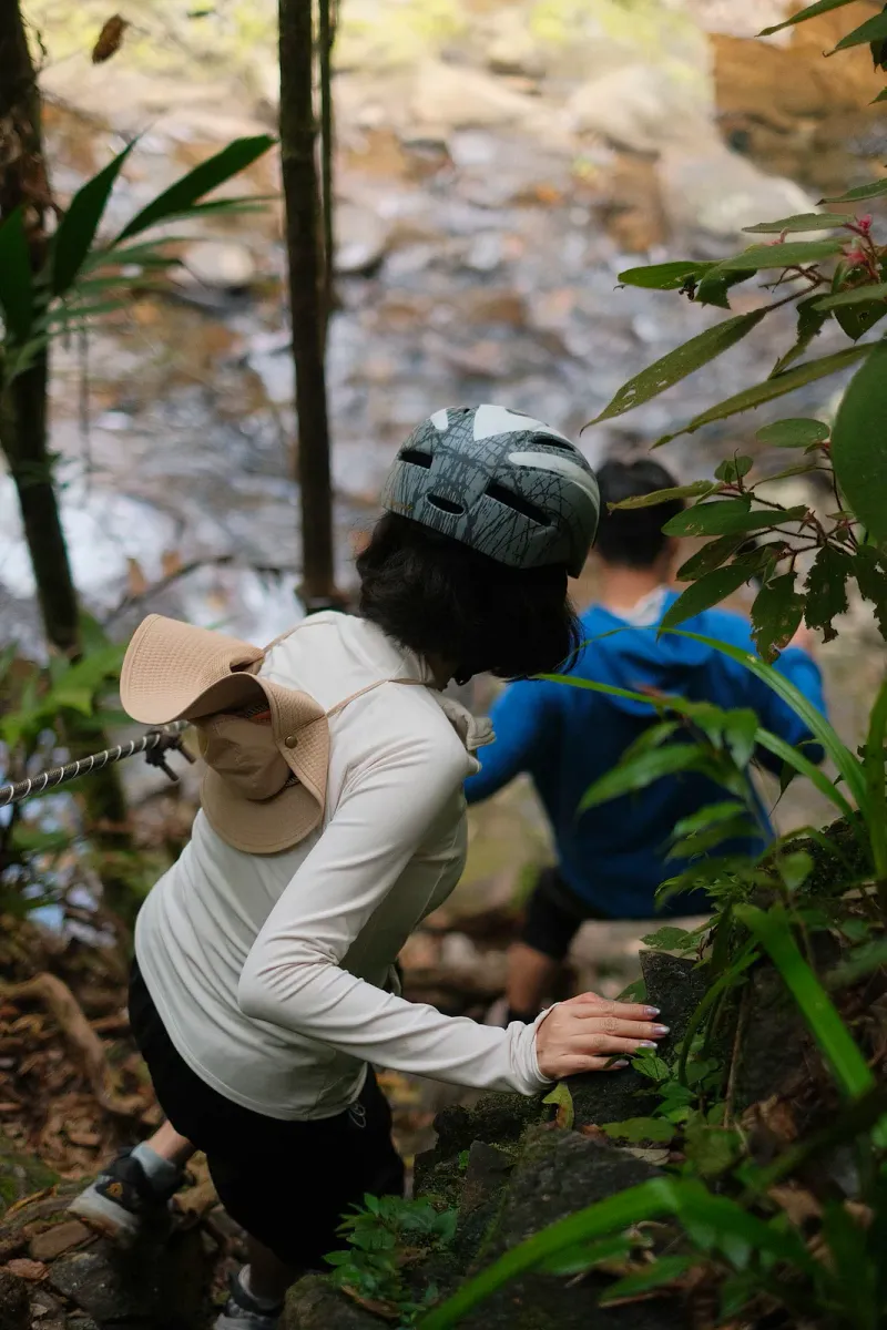
This makes the Hog Trail a good match for travelers based on Koh Samui’s northwest coast (Maenam, Bang Po, and the Na Phra Lan area) who want a genuine forest workout without driving across the island to Na Muang or Khao Pom. It’s not a manicured park trail with railings and signage; it’s a community-mapped forest path best tackled with a downloaded GPS track, sturdy shoes, and realistic expectations about the climb.
Trail Details
| Stat | Detail |
|---|---|
| Total distance | 5.2 km round trip |
| Elevation gain | ~314 m (311 m descent) |
| Highest point | ~479 m above sea level |
| Lowest point | ~164 m above sea level |
| Time | ~1 hour 58 minutes average |
| Difficulty | Easy (community rating), feels Easy-Moderate due to the opening climb |
| Trail type | Point-to-point forest path (out-and-back logistics recommended) |
| Markings | None official: GPS track strongly recommended |
| Cost | Free, no entry fee |
| Starting coordinates | 9.5672° N, 99.9534° E |
The Hog Trail sits in the hills inland from Koh Samui’s northwest coast, in the general vicinity of Na Phra Lan and the ridge that separates Maenam from the island’s interior, a mountainous island profile described in more depth on Wikipedia’s Ko Samui overview. Because it isn’t a government-managed trail inside a national park, there’s no visitor center, no printed map, and no rangers: everything a hiker needs to know comes from GPS tracks recorded by previous visitors. Bring a downloaded route (from AllTrails or Outdooractive) rather than relying on painted trail markers, which are largely absent.
The Steep Beginning: What to Expect on the Ascent
Why the start feels harder than “Easy”
Every account of the Hog Trail mentions the same detail: the opening section is a pretty steep ascent, climbing quickly away from the trailhead before the gradient eases into rolling forest terrain. Because Koh Samui’s interior rises abruptly from a narrow coastal plain, hikes that start near sea level often front-load their elevation gain: the Hog Trail is a textbook example. Expect to gain a meaningful share of the trail’s 314 m total within the first 15-20 minutes.
Pacing advice
- Start slow: the steep opening is not the place to set your pace for the whole hike
- Short, frequent water breaks work better than pushing straight through the first climb
- The trail rewards patience: once past the initial ascent, the terrain rolls rather than continuously climbs
- Trekking poles are not particularly useful here: loose forest floor and tree roots make hands-free scrambling more practical on the steepest meters
The Forest Canopy: Flora and Terrain
What the forest looks like
The Hog Trail runs through mixed secondary tropical forest typical of Koh Samui’s undeveloped interior hills: a mix of tall hardwoods, bamboo stands, broadleaf undergrowth, and the kind of dense canopy that keeps the trail shaded for most of its length. This is a genuine advantage in Samui’s heat: unlike coastal walks, very little of the Hog Trail is exposed to direct sun.
Surface conditions
- Natural dirt and leaf-litter surface throughout: no pavement, boardwalks, or steps
- Tree roots and loose stone sections, particularly on the steep opening climb
- Surface becomes noticeably more slippery after rain, as with most unpaved trails on the island
- No river crossings or water features reported along the route
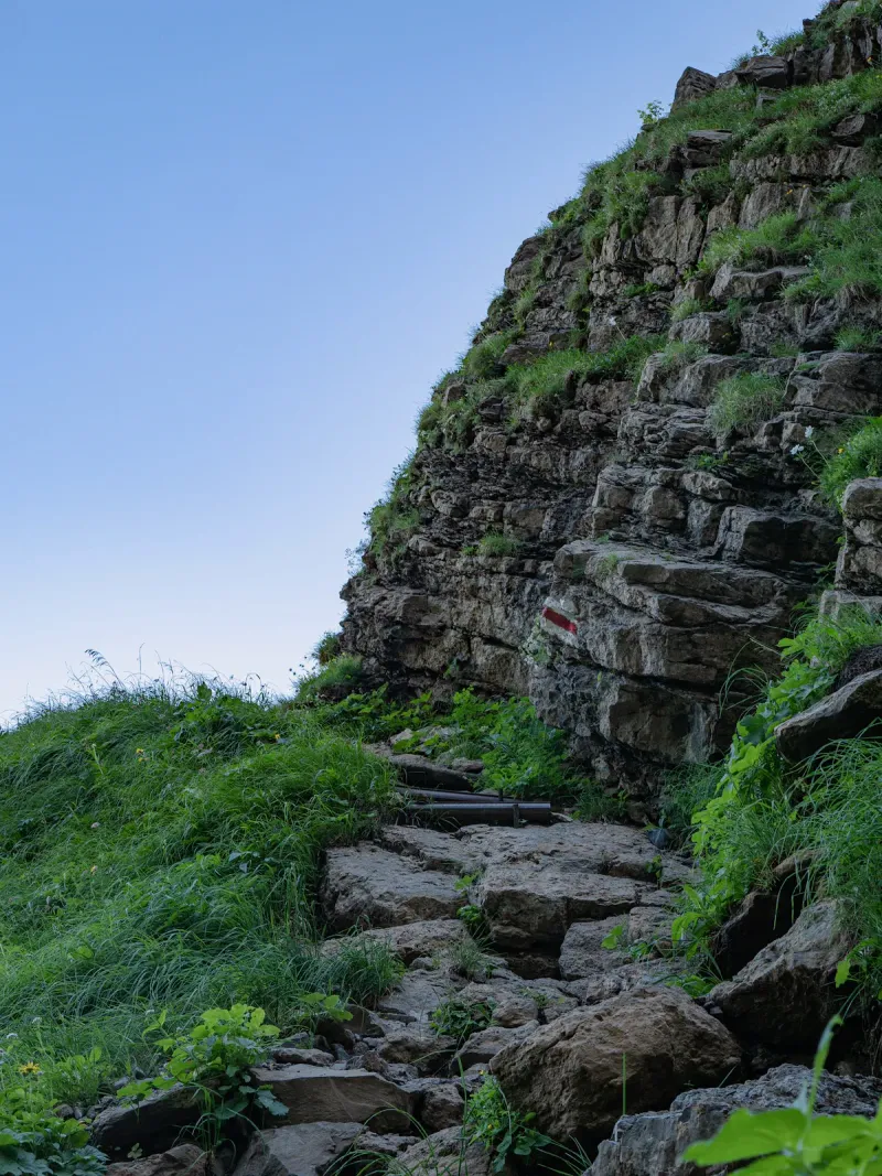
Because the trail isn’t maintained by a park authority, fallen branches or overgrown sections can appear between visits. This is normal for an unofficial forest track and part of why proper footwear and a GPS track matter more here than on Koh Samui’s better-known, ticketed hiking routes like the Na Muang Waterfalls Trail.
Wildlife on the Hog Trail
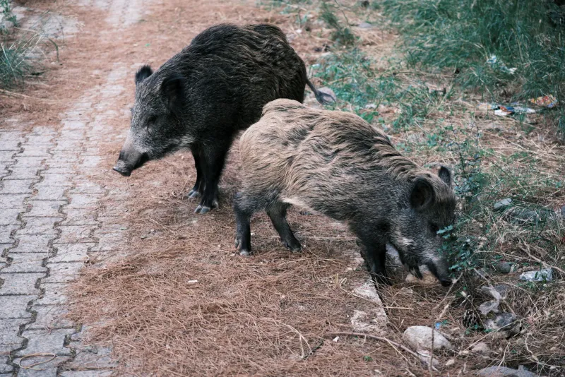
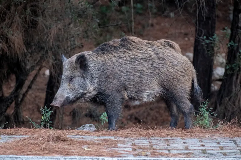
The trail’s name is a strong hint about one resident: wild boar are known to move through Koh Samui’s interior forest, and trails like this one (quiet, rarely used, away from resorts) are exactly where their presence is most likely to leave a mark on the landscape (and possibly on the trail name itself).



What you might encounter
- Wild boar signs: rooting marks in soft ground, though boar themselves are rarely seen by day
- Monitor lizards, common across Koh Samui’s forested interior
- Birds typical of secondary tropical forest: bulbuls, sunbirds, and the occasional hornbill call
- Butterflies and insects, especially in the shadier middle sections
- Dense undergrowth species: ferns, wild ginger, and bamboo thickets
As on any quiet forest trail in Thailand, wildlife is more often heard than seen, and early morning hikers have the best odds of a sighting before the heat of the day settles in.
Getting There
Location
The Hog Trail starts inland from Koh Samui’s northwest coast, near the Na Phra Lan area between Nathon and Maenam. The trailhead sits at approximately 9.5672° N, 99.9534° E: close enough to the coast road that a scooter or car can reach the start, but far enough into the hills that there’s no coastal view from the trailhead itself.
From different areas
| Starting Point | Drive Time | Taxi Cost (approx.) |
|---|---|---|
| Maenam Beach | ~10-15 min | 250-400 THB |
| Nathon (ferry pier) | ~15-20 min | 300-450 THB |
| Bophut / Fisherman’s Village | ~20-25 min | 400-500 THB |
| Chaweng | ~35-40 min | 600-800 THB |
Transport
- Scooter: The most practical option. The author’s own trail notes mention parking a bike right at the start. Expect ~150-250 THB/day rental.
- Taxi: Possible but negotiate the fare in advance; Koh Samui taxis don’t use meters, and a driver may need the GPS pin rather than a place name.
- Self-navigation: Because the trail has no official signage, use a downloaded GPS track to find both the trailhead and the route itself. Don’t rely on road signs.
There’s no formal parking area, ticket booth, or facilities at the start: this is an undeveloped trailhead, not a tourist attraction with infrastructure.
Best Time to Hike
| Season | Months | Trail Conditions | Rating |
|---|---|---|---|
| Cool/dry season | Dec-Feb | Firm ground, comfortable temperatures, best visibility | ★★★★★ |
| Dry/hot season | Mar-May | Dry underfoot but hot and humid on the steep climb | ★★★ |
| Early monsoon | Jun-Sep | Increasingly slippery roots and loose stone | ★★★ |
| Peak monsoon | Oct-Nov | Muddy, slippery, higher risk on the steep opening section | ★★ |
Best time of day: Early morning (7-9 AM) beats both the midday heat on the exposed opening climb and the higher odds of afternoon downpours during the wetter months. Because the forest canopy shades most of the route, the main heat exposure is during that first steep ascent: starting early makes the biggest difference there.
What to Bring
| Item | Why |
|---|---|
| Sturdy trail shoes | Loose stone and roots on the steep opening climb; flip-flops are not suitable |
| Water (1-1.5L) | No water sources or vendors anywhere on the route |
| Downloaded GPS track | No official trail markers; phone signal in the forest can be unreliable |
| Sun protection | Needed for the exposed early climb, less so once under canopy |
| Insect repellent | Standard precaution for any Koh Samui forest trail |
| Snacks | Nothing available on or near the trail: bring your own |
Safety and Trail Conditions
Low-risk overall, but respect the climb
The Hog Trail’s Easy community rating reflects its manageable length and lack of technical climbing: there are no rope sections, cliff edges, or via ferrata elements like those on Koh Samui’s more famous Na Muang 2 route. The main hazard is straightforward: the steep opening ascent on a loose, unmaintained surface, which becomes genuinely slippery when wet.
Practical safety notes
- Avoid hiking during or right after heavy rain: the dirt-and-root surface loses grip quickly
- No trail markers: a GPS track is the difference between a pleasant 2-hour hike and getting turned around in secondary forest
- Phone signal can drop in the forest interior; tell someone your plan before setting out
- No facilities, rescue infrastructure, or regular foot traffic: this is a quiet trail, so solo hikers should be extra cautious about turning back if conditions deteriorate
- Wildlife caution: wild boar can be defensive if surprised at close range; stick to the trail rather than bushwhacking
Compared to trails inside Koh Samui’s more developed hiking areas, the Hog Trail’s biggest risk factor is simply its obscurity: help is further away, and the surface hasn’t been engineered for safety the way a maintained park path has.
Nearby Attractions
Because the Hog Trail sits inland from Koh Samui’s northwest coast, several other low-key attractions are within a short drive.
Under 15 minutes
- Wat Na Phra Lan: a quiet royal-associated temple in the same Na Phra Lan/Maenam hill area, a good cultural stop before or after the hike
- Maenam Beach: the nearest sandy coastline for a post-hike swim and sunset
Under 25 minutes
- Tan Rua Waterfall: a hidden jungle waterfall in the Maenam interior, reachable via Maenam Soi 5
- Khun Si Waterfall Trail: another forested hike further east through durian plantations toward the central highlands
Pairing the Hog Trail with a beach afternoon at Maenam or a coffee stop near Na Phra Lan makes for a full, low-cost half-day on Koh Samui’s quieter northwest side.
Who Is the Hog Trail Best For?
| Hiker Type | Fit | Why |
|---|---|---|
| Fitness-focused hikers | ★★★★★ | A real cardio workout in ~2 hours without a full-day commitment |
| Off-the-beaten-path travelers | ★★★★★ | Almost no tourist traffic, no entry fee, minimal online coverage |
| Budget travelers | ★★★★★ | Completely free: only cost is scooter rental or a taxi fare |
| Casual walkers | ★★★ | The steep opening climb is more demanding than a typical short beach walk |
| Photographers | ★★★ | Dense canopy forest rather than waterfalls or viewpoints |
| Families with young kids | ★★ | Steep terrain and no facilities make it better suited to older kids and adults |
| First-time visitors to Samui | ★★★ | Better suited to hikers who already know the island or are comfortable with GPS-only navigation |
FAQ
How long is the Hog Trail on Koh Samui?
The Hog Trail is 5.2 km round trip with approximately 314 m of elevation gain. Most hikers complete it in around 2 hours, though the steep opening climb can slow a first-time visitor down by 10-15 minutes compared to the average recorded time.
Is the Hog Trail difficult?
Community trail data rates the Hog Trail as Easy overall, but the steep ascent right at the start makes it feel closer to Easy-Moderate for casual walkers. There are no technical climbing sections, but sturdy shoes and reasonable fitness for a sustained uphill push are recommended.
Where does the Hog Trail start on Koh Samui?
The trailhead sits inland from the northwest coast near Na Phra Lan, roughly 9.5672° N, 99.9534° E, between Nathon and Maenam. There’s no signposted entrance, so hikers should use a downloaded GPS track from AllTrails or Outdooractive to find the exact starting point.
Do I need a guide for the Hog Trail?
No guide is required, but the Hog Trail has no official trail markers, so a downloaded GPS route is strongly recommended. Phone signal can be unreliable in the forest interior, so download the track before arriving rather than relying on a live connection.
Is the Hog Trail free to hike?
Yes. Unlike Koh Samui’s ticketed waterfall trails, the Hog Trail has no entry fee, parking charge, or facilities of any kind: it’s an unofficial forest route rather than a managed attraction.
What’s the best time of year to hike the Hog Trail?
November through February offers the firmest underfoot conditions and most comfortable temperatures for the steep opening climb. The wetter months from October to November bring a higher risk of slippery roots and loose stone on that same section.
Published Updated
About the author

Mike Brochlowski
Travel photographer & writer
Travel photographer and island explorer. Mike has spent years documenting Southeast Asia's hidden gems, from secluded beaches to jungle waterfalls.
Articles by Mike →More in Hiking
2.5 km away
Ban Tai Beach, Koh Samui: Quiet Maenam Coast Snorkeling
Ban Tai Beach is on Koh Samui's north coast (not Phangan), between Bang Po and Maenam: a quiet 1-2 km stretch with reef snorkeling, ~20 m…

2.5 km away
Thong Plu Beach: Koh Samui's Quiet Northwest Corner
Thong Plu Beach is an isolated, very shallow stretch on Koh Samui's northwest edge: laid-back, undeveloped, and rarely visited by tourists.

Next in Hiking
Overlap Stone Samui Viewpoint: How to Get There and How Hard
Overlap Stone Samui is a 0.5 km, 15-20 minute climb above Lamai: turn off at Wat Sila Ngu, pay ~200-300 THB, hike or take the free truck…