Contents
Overview
The Khao Nui Loop (เขาหนุ่ย) is one of Koh Samui’s least-crowded hikes: an ~8.7 km forest circuit through the hills behind Na Mueang, in the island’s south-central interior. Most visitors finish the loop in ~2 hours at a brisk pace, though AllTrails logs for the same route (listed there as the Khao Nui - Samui Viewpoint Loop) show a wider range of ~2 to 3.5 hours depending on fitness and photo stops. Unlike the island’s famous waterfall trails, Khao Nui rarely sees a crowd, which is exactly why hikers who want quiet time in the jungle (and a real shot at spotting birds) seek it out.
The trail is rated moderate: no technical climbing or rope sections, but a sustained, rolling gradient through forest and bamboo groves that adds up over the full loop. It doubles as a mountain-biking route, so expect a wider, more rideable track than a typical single-track jungle trail.
Key facts: ~8.7 km loop · ~2-3.5 hours · Moderate difficulty · Free to hike · Trailhead opposite Wat Khunaram on the Ring Road · Bird watching and mountain biking · Best avoided Mar-May (haze season)
Because the loop climbs into the hills below Khao Pom (at 635 meters the island’s highest point) and passes close to the Secret Buddha Garden, it can be combined with a visit to either without much extra driving. For travelers who’ve already ticked off Chaweng’s beaches and Na Muang’s waterfalls, Khao Nui is the next step: a genuine forest hike that still doesn’t require a guide or technical gear.
Trail Details
| Stat | Detail |
|---|---|
| Total distance | ~8.7 km loop |
| Time | ~2 hours (fast pace) up to ~3.5 hours (relaxed pace with stops) |
| Difficulty | Moderate |
| Trail type | Loop (out-and-back sections possible) |
| Elevation gain | ~400-425 m over the full loop |
| Surface | Dirt and gravel track, wide enough for mountain bikes |
| Markings | Limited: a GPS track or offline map is recommended |
| Cost | Free (no entry fee for the trail itself) |
| Best for | Solo hikers, bird watchers, mountain bikers |
The 8.7 km figure covers the full Khao Nui circuit through the forest behind Na Mueang. Some GPS trackers and AllTrails logs of the same general loop record slightly different numbers, commonly ~8.2 km (5.1 miles) with ~425 m of elevation gain, which is normal for an unpaved trail where exact tracked distance depends on the route variation taken. Treat the figures here as a solid planning estimate rather than a surveyed measurement.
The Route: What to Expect
From the trailhead
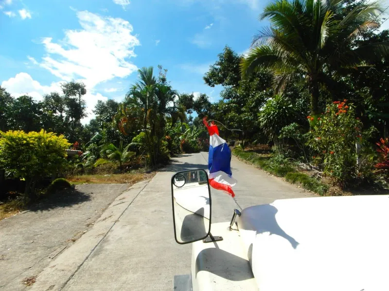
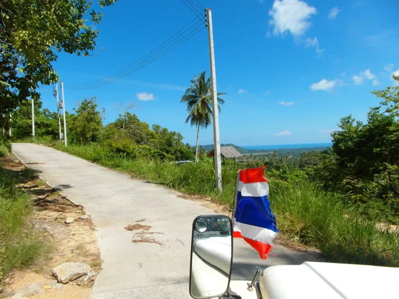
The loop begins near the entrance opposite Wat Khunaram on the Ring Road (Route 4169), the same junction that’s signposted toward the Secret Buddha Garden. A short stretch of paved access road gives way to packed dirt within the first few hundred meters.
Through the forest
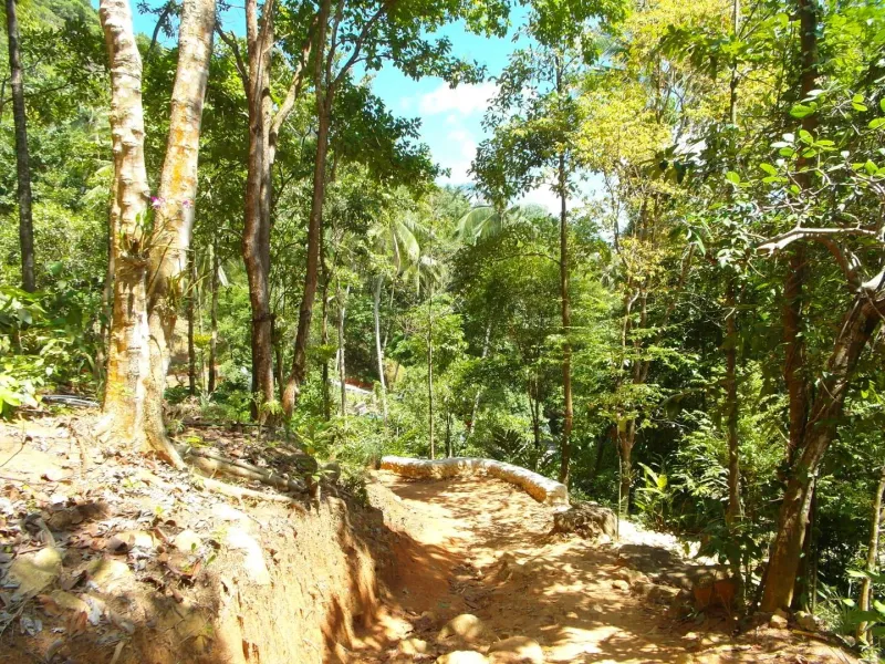
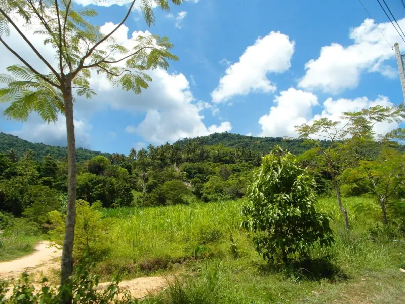
The middle portion of the loop is where Khao Nui earns its reputation. The trail winds through stretches of secondary forest, passing beneath tall trees and through dense bamboo groves where the light turns green and the temperature drops a few degrees. Ferns, wild ginger, and tangled undergrowth crowd the path edges in places.
The high ground
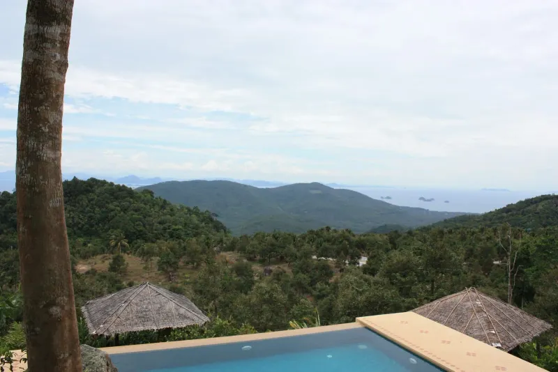
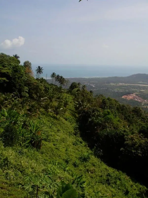
Where the loop gains the most elevation, gaps in the canopy open onto views across Koh Samui’s interior toward the coast: a reward for the climb, and one of the better lookout points for anyone who hasn’t hiked up to Khao Pom or the Secret Buddha Garden itself.
Closing the loop
The final leg descends back toward the Ring Road, rejoining close to the starting point. Because it’s a loop rather than an out-and-back, you won’t retrace your steps: a plus for hikers who find repeat scenery tedious on longer trails.
Bird Watching on Khao Nui
Bird watching is one of the two headline activities on this trail, alongside mountain biking. The mixed forest and bamboo cover attracts a good range of lowland tropical species typical of Koh Samui’s interior: sunbirds, bulbuls, and kingfishers are commonly reported in the forested sections of the island’s hill trails, alongside the occasional monitor lizard or dusky langur troop moving through the canopy.
Early morning (before ~9 AM) is by far the best window: birds are most active, the heat hasn’t built up, and the trail, already quiet, is at its most peaceful. Bring binoculars if birding is your main goal; the trail doesn’t have viewing platforms or hides, so most sightings happen on the move.
Mountain Biking the Loop
Khao Nui’s track is wide and graded enough that it doubles as one of Koh Samui’s recognized mountain-biking routes. The same rolling terrain that makes the hike “moderate” on foot translates to a solid intermediate ride on two wheels: climbs steep enough to work for, descents with enough flow to be fun, and a loop format that means no backtracking.
Riders should bring their own bike, as there’s no rental point at the trailhead. Given the limited trail markings, downloading a GPS track before setting out is worth doing whether you’re hiking or riding.
Wildlife and Jungle Flora
The Khao Nui area sits within Koh Samui’s central hill forest, adjoining terrain that stretches up toward Khao Pom. It’s not primary rainforest in the way the deep interior around Khao Pom is, but the mix of secondary forest and bamboo still supports meaningful biodiversity for an island this size.
What to look and listen for:
- Birds: sunbirds, bulbuls, kingfishers, and other lowland species, most active early morning
- Butterflies: numerous along sunlit clearings and near any damp ground
- Monitor lizards: sometimes seen basking on open, sun-warmed ground
- Dusky langurs: occasionally spotted moving through the canopy, more likely at dawn
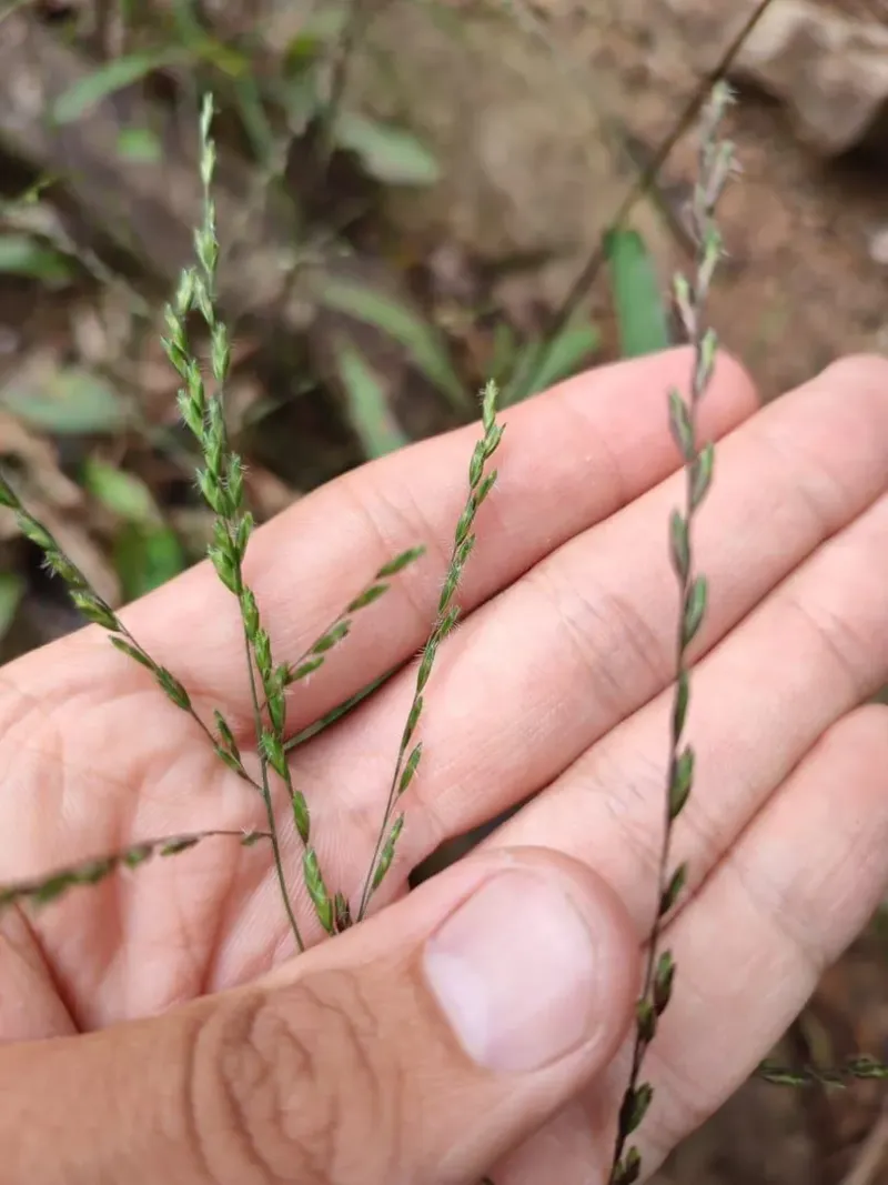
- Bamboo groves and ferns: the trail’s most distinctive plant life, especially through the mid-loop shaded sections
Because the trail sees relatively light foot traffic compared to Na Muang or Hin Lad, wildlife here tends to be less habituated to people: a plus for observation, but it also means sightings aren’t guaranteed on any given walk.
Getting There
Khao Nui sits inland from the southern stretch of the Ring Road, between Na Muang and Hua Thanon: the same general area as Wat Khunaram and the Secret Buddha Garden turnoff.
| Starting Point | Drive Time | Taxi Cost |
|---|---|---|
| Nathon | ~15-20 min | ~350-500 THB (~10-14 USD) |
| Lamai | ~15-20 min | ~350-500 THB (~10-14 USD) |
| Chaweng | ~25-30 min | ~550-750 THB (~16-21 USD) |
| Bophut | ~30-35 min | ~650-900 THB (~19-26 USD) |
Transport options
- Scooter: the most practical way in; rentals run ~150-250 THB (~4.50-7 USD) per day. Follow Route 4169 to the entrance opposite Wat Khunaram, then the signed turnoff toward the Secret Buddha Garden.
- Taxi: agree a fixed price before setting off; Samui taxis don’t run on meters.
- Private driver / tour: some half-day interior tours combine Khao Nui with the Secret Buddha Garden and Khao Pom viewpoints.
There’s no dedicated paid car park at the Khao Nui trailhead itself; hikers commonly park near the Ring Road junction or, if continuing on to the viewpoint restaurant above, at Giant Summit, roughly along the same access road.
Nearby Attractions
Khao Nui’s location in the Na Mueang hills puts it within easy reach of some of Koh Samui’s best interior sights, making it easy to build a half-day loop around the hike.
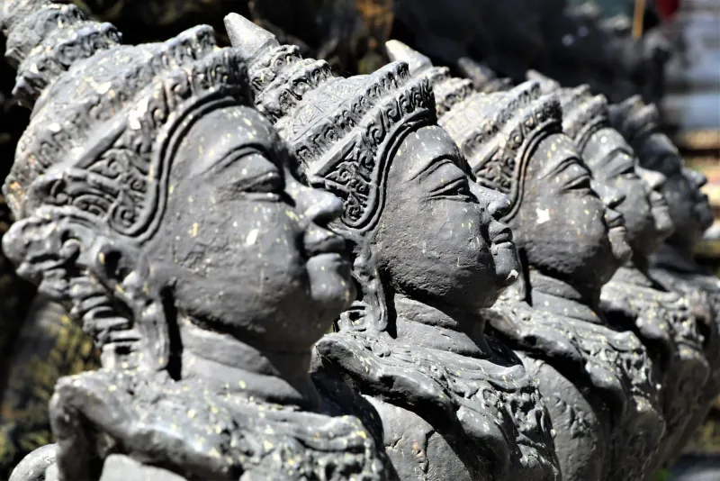
- Secret Buddha Garden (~10-15 min drive): a mystical hillside sculpture garden built by a local farmer, with dozens of stone statues set among jungle and streams.
- Tarnim Magic Garden (~10-15 min drive): the same Pom Mountain sculpture park approached from its waterfall side, with a stream and swimming pool.
- Giant Summit: a hillside restaurant and viewpoint along the access road, good for a meal with a view after the hike.
- Wat Khunaram (~5 min drive): the temple opposite the trailhead entrance, notable for the preserved body of a meditating monk, Luang Pho Daeng.
- Na Muang Waterfalls Trail (~15-20 min drive): Koh Samui’s most popular jungle hike, with swimming pools at both ends.
Best Time to Hike Khao Nui
| Season | Months | Conditions | Rating |
|---|---|---|---|
| Cool/dry | Dec-Feb | Comfortable temperatures, clear air, firm trail | ★★★★★ |
| Late dry | Mar-May | Hot, and this is the region’s smoky/haze season, when agricultural burning elsewhere in Thailand can reduce visibility | ★★ |
| Early monsoon | Jun-Aug | Green, humid, occasional showers | ★★★ |
| Peak wet | Sep-Nov | Slippery sections, higher rain risk | ★★★ |
Best time of day: early morning (before ~9 AM) for cooler temperatures, more active birdlife, and softer light for photos. Avoid setting out for the loop in the hour before dark: trail markings are limited and there’s no lighting.
What to Bring
| Item | Why |
|---|---|
| Breathable long pants | Protects against mosquitoes and tall grasses along the mid-loop sections |
| Water (1.5L+) | ~2-3.5 hours of walking in tropical heat with no vendors on the trail |
| Sturdy shoes with grip | The dirt track can be loose in places, especially after rain |
| Insect repellent | Bamboo and forest sections hold mosquitoes year-round |
| Binoculars | Useful if bird watching is a priority |
| Offline map or GPS track | Trail markings are limited; download a route before setting out |
Safety and Practical Tips
- Go early. Starting before 9 AM avoids the worst heat and gives the best chance of birdlife activity.
- Tell someone your plan. Khao Nui is popular precisely because it’s quiet, which also means fewer other hikers around if something goes wrong. Share your route and expected return time if hiking solo.
- Watch the weather. Heavy rain turns the dirt track slick; the loop is best avoided during or right after a downpour.
- Carry more water than you think you need. There are no shops or water points on the route itself.
- Respect the smoky season. From roughly March to May, seasonal haze can reduce both visibility and air quality; if you’re sensitive to smoke, consider a cooler-season visit instead.
- Combine carefully. If pairing the hike with the Secret Buddha Garden or Giant Summit, budget separate time: don’t rush either to fit a tight schedule.
Who Is Khao Nui Best For?
| Hiker Type | Fit | Why |
|---|---|---|
| Solo hikers | ★★★★★ | Quiet trail, moderate difficulty, no technical sections: a common pick for solo Koh Samui hikes |
| Bird watchers | ★★★★★ | Mixed forest and bamboo habitat with low foot traffic |
| Mountain bikers | ★★★★ | Wide, rideable track with real elevation change |
| Fitness-focused hikers | ★★★★ | ~8.7 km and ~400 m of gain is a genuine moderate workout |
| Families with young kids | ★★ | Length and limited markings make it a stretch for small children |
| First-time Samui hikers | ★★★ | Doable without a guide, but less signposted than Na Muang |
| Photographers | ★★★★ | Forest light, bamboo groves, and interior viewpoints |
FAQ
How long is the Khao Nui Loop hike?
The Khao Nui Loop covers ~8.7 km on a moderate forest trail. Most hikers finish in ~2 hours at a steady pace, though AllTrails logs of the same general route show times up to ~3.5 hours for a relaxed pace with photo stops and birding pauses.
Where does the Khao Nui trail start?
The trailhead sits near the entrance opposite Wat Khunaram on the Ring Road (Route 4169), the same junction signposted toward the Secret Buddha Garden. From there, a short paved stretch gives way to the dirt loop trail.
Is Khao Nui good for bird watching?
Yes: Khao Nui is one of Koh Samui’s better bird watching trails thanks to its mix of forest and bamboo habitat and relatively light foot traffic. Early morning, before roughly 9 AM, gives the best chance of spotting sunbirds, bulbuls, and kingfishers.
Do I need a guide for Khao Nui?
No guide is required. The trail is walkable independently, though markings are limited, so downloading an offline map or GPS track before setting out is recommended, especially for first-time visitors to Koh Samui’s interior trails.
Can I mountain bike the Khao Nui Loop?
Yes: the wide, graded dirt track is one of Koh Samui’s recognized mountain-biking routes, with enough elevation change to make for an engaging intermediate ride. Bring your own bike, as there’s no rental point at the trailhead.
What’s the best time of year to hike Khao Nui?
December through February offers the most comfortable temperatures and clearest air. Avoid March through May if possible: it’s the region’s smoky, hazy season from agricultural burning, which can reduce both visibility and air quality on exposed sections of the trail.
Published Updated
About the author

Migues Ferfumoz
Writer, Koh Samui resident since 2019
Freelance writer and Koh Samui resident since 2019. Migues covers local culture, food, and the best off-the-beaten-path destinations on the island.
Articles by Migues →More in Hiking
1.6 km away
Wang Sao Thong Waterfall: Koh Samui's Hidden Jungle Oasis
Discover Wang Sao Thong Waterfall on Koh Samui.
1.7 km away
Wat Samret: The Temple of the Solid Marble Buddha
Discover Wat Samret, one of Koh Samui's oldest temples.
Next in Hiking
Tartain Waterfall Trek: Samui's Ultimate Jungle Challenge
Experience the Tartain Waterfall Trek on Koh Samui.