Overview
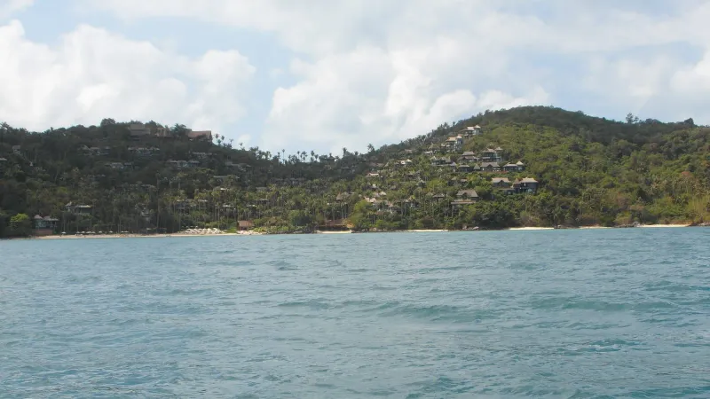
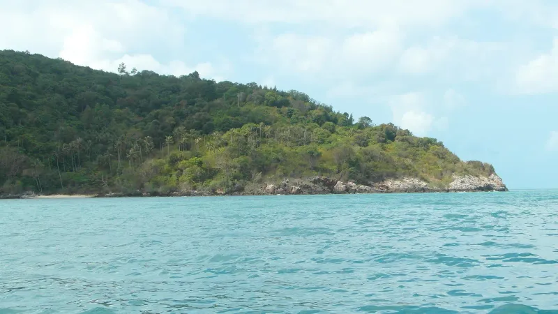
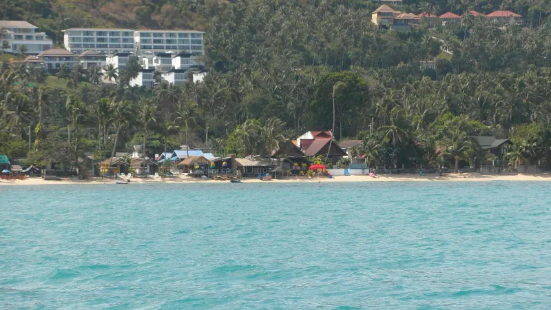
Thong Plu Beach (หาดทองพลู) sits on the northwest corner of Koh Samui, Thailand, in the stretch of coastline where the island’s west-facing shore bends around to meet the north coast. It is one of the least-visited named beaches on Samui: very shallow, largely undeveloped, and quiet enough that most visitors have never heard of it, let alone stood on its sand.
There is no resort strip here, no beach-bar row, no vendors renting sun loungers. Thong Plu is flanked by two similarly overlooked bays, Laem Yai to the southwest and Bang Po to the northeast, and the whole corner of the island shares the same character: coconut palms, a narrow coastal lane, small local houses, and water that stays ankle-to-knee deep for a long way out. If Chaweng and Lamai are Koh Samui’s front porch, Thong Plu is a back room nobody bothers to show visitors.
That is precisely the appeal. Samui International Airport is roughly 25-30 minutes away by car, and the drive itself (along the quieter interior lanes rather than the busy Route 4169 ring road near Chaweng) is part of the reset. Nathon, the island’s port town and administrative center, is about 15-20 minutes to the south. Beyond a handful of local homes and the occasional fisherman’s boat pulled onto the sand, there is very little to interrupt the view.
History: What Does the Name Mean?
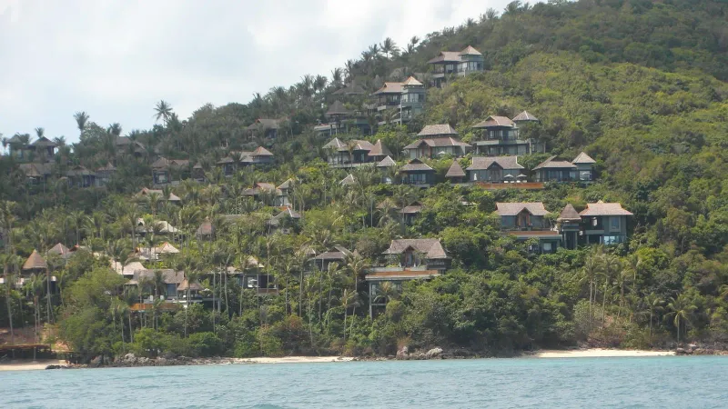
Thai beach names on Koh Samui are almost always descriptive rather than commemorative, built from what grew or gathered there before tourism arrived. “Thong” (ทอง) commonly appears in Samui place names (Thong Krut, Thong Tanote, Thong Sai Bay) and generally references gold or a bay-like inlet, while “phlu” (พลู) is the betel-leaf vine once cultivated widely across rural Thailand for chewing with areca nut. Put together, the name most likely points to betel plants that once grew along this stretch of coast, a pattern repeated in dozens of small Thai coastal communities that never had a more dramatic story to tell.
Like most of Koh Samui’s northwest corner, Thong Plu was historically a coconut-farming and small-scale fishing area, not a settlement of any size. The island’s tourism boom of the 1980s and 1990s reshaped Chaweng, Lamai, and later the north coast around Bophut and Maenam, but it largely passed this corner by. There was no natural harbor to attract a fishing fleet, no dramatic rock formation to draw photographers, and no easy access road until relatively recently: three reasons the beach remains close to how it must have looked decades ago.
A working coastline, not a tourist one
Walk the shoreline today and what you find is closer to rural Thailand than resort Thailand: modest homes set back from the sand, small vegetable plots, drying racks, and the occasional longtail boat. Locals use the beach the way people use a beach when tourism hasn’t reorganized it around them: for a quick swim after work, for launching a boat, for letting kids play in ankle-deep water after school.
The Beach: Sand, Shallows and Tides
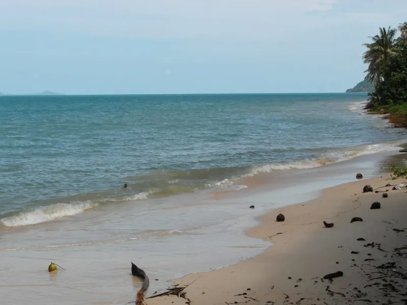
Thong Plu’s defining physical feature is how shallow it is. Even a good distance from the shoreline, the water frequently stays at wading depth, a characteristic shared with several of Samui’s northwest and west-coast beaches where the seabed slopes very gradually rather than dropping off. At low tide, sizeable stretches of the sandy-muddy flat are exposed, and the “beach” effectively widens by tens of meters.
The sand itself is a mix of fine sand and firmer, slightly muddier patches closer to the tideline, not the postcard white powder of Chaweng or Choeng Mon, but serviceable and comfortable underfoot. Coconut palms and low coastal scrub line the back of the beach in most sections, offering natural shade that doesn’t require a resort umbrella.
Tide dependence
Because the gradient is so gentle, Thong Plu is highly tide-dependent. At high tide there is a workable strip of sand for sitting, walking, and a shallow dip. At low tide, swimming in the conventional sense becomes difficult: you may need to walk out a considerable distance before the water reaches waist height, and exposed flats can include patches of mud, seagrass, or scattered shells. Water shoes are a sensible precaution, as they are on most of Samui’s shallow northwest beaches.
Compared to its neighbors
Laem Yai, just to the southwest, is a smaller, more enclosed cove with clearer water close to shore. Bang Po, to the northeast, is a longer and better-known stretch with a few seafood restaurants and reef patches for snorkeling. Thong Plu sits between the two in character (less enclosed than Laem Yai, less developed than Bang Po), which is largely why it remains the quietest of the three.
Activities at Thong Plu
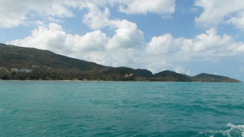
Thong Plu is not built for an activity checklist, and that is the point. What it offers is a short, specific list of things done well precisely because nobody else is doing them alongside you.
- Wading and shallow swimming: The main activity, and best attempted within an hour or two either side of high tide, when there is enough depth to actually swim rather than wade.
- Beachcombing and shell-hunting: The exposed flats at low tide reveal shells, small crabs, and the occasional starfish, a genuine draw for children and casual naturalists, if not for serious swimmers.
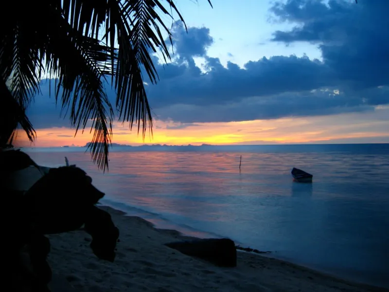
- Photography: The combination of empty sand, coconut palms, and a wide reflective tide flat at sunset makes Thong Plu quietly photogenic, especially compared with the crowded frames you’d get at Chaweng or Bophut.
- Walking the shoreline toward Laem Yai or Bang Po: At low tide, it’s possible to walk a considerable stretch of the connected shoreline in either direction, passing between the three bays without needing a boat or a road.
- Watching local fishing life: Small longtail boats occasionally launch from or return to the beach, offering a low-key glimpse of a working coastline rather than a curated “authentic fishing village” tour stop.
There are no water-sports operators, no jet-ski rentals, and no snorkeling tour desks at Thong Plu itself. Visitors who want organized activities (kayaking, paddleboarding, diving day trips) typically arrange them from Maenam or Bophut on the north coast, both a reasonably short drive away.
Where to Eat Near Thong Plu
There is essentially no dedicated restaurant scene directly on Thong Plu Beach: no beachfront bar, no seafood shack with tables on the sand. This is one of the honest trade-offs of visiting somewhere this undeveloped, and worth planning around rather than discovering on an empty stomach.
| Option | Distance | What to Expect |
|---|---|---|
| Local village shops | Along the coastal lane | Basic snacks, drinks, and convenience items; no sit-down menu |
| Bang Po seafood restaurants | ~10-15 min by scooter or car | Thai seafood, grilled fish, casual beachfront tables |
| Nathon town | ~15-20 min by car | The widest choice on this side of the island: noodle shops, markets, cafes, and the pier-side food stalls |
| Maenam village | ~20-25 min by car | Restaurants, a Thursday night market, and resort dining options |
Practical approach
Most visitors either bring their own food and water for a picnic-style visit, or treat Thong Plu as a short stop on a wider loop of the island’s west and north coasts that includes a proper meal in Nathon or Bang Po. Bottled water is worth carrying: there is no guarantee of a shop being open nearby, especially outside daylight hours.
Nearby Attractions
Thong Plu’s northwest position puts it within a reasonable drive of several other under-the-radar spots, plus a couple of Samui’s better-known sights.
Under 15 minutes
- Laem Yai Beach: A smaller, more enclosed cove immediately to the southwest, one of the most secluded beaches on the island.
- Bang Po Beach: A longer stretch to the northeast with Thai seafood restaurants and a reef suitable for casual snorkeling.
Under 30 minutes
- Wat Na Phra Lan: A quiet, rarely-crowded temple near Maenam with a notable King Rama V statue and a sacred well, offering a cultural stop that pairs naturally with a beach day on this side of the island.
- Maenam Beach: One of Samui’s longest and calmest beaches, with a Thursday night market and considerably more dining and accommodation choice.
- Ban Tai Beach: A quiet north-coast stretch with a rocky headland and reef snorkeling, roughly midway between the northwest corner and Maenam.
- Nathon town: The island’s main port and administrative hub, with markets, shops, and ferry connections to the mainland at Surat Thani.
Under 45 minutes
- Lipa Noi Beach: A long, shallow, west-facing beach on the opposite side of the island’s western bulge, known for sunset views toward the Ang Thong archipelago.
- W Beach: A small, private-feeling cape beach between Maenam and Bophut that widens dramatically at low tide, much like Thong Plu itself but with a resort attached.
Where to Stay
Thong Plu itself has no dedicated hotels, guesthouses, or resorts: a direct consequence of the area’s minimal tourism infrastructure. Visitors who want to base themselves genuinely close to this stretch of coast have limited options, and most choose to stay elsewhere and treat Thong Plu as a day visit.
| Area | Distance from Thong Plu | Character |
|---|---|---|
| Nathon | ~15-20 min | Budget guesthouses and simple hotels aimed at ferry travelers rather than beach tourists |
| Bang Po / Maenam | ~15-25 min | The nearest real range of hotels, from budget bungalows to five-star resorts like Santiburi and W Koh Samui |
| Lipa Noi / Taling Ngam | ~25-40 min | West-coast resorts oriented around sunset views and quiet, low-key stays |
For most travelers, the practical approach is to base in Maenam or Bang Po (both within a short scooter ride) and treat Thong Plu as a quiet half-day excursion rather than a home base.
Getting There
From Samui Airport (USM)
Thong Plu is roughly 25-30 minutes by car from the airport, following the ring road west and then cutting north along local coastal lanes past Nathon.
- Airport taxi: Typically 500-700 THB (~14-20 USD) given the distance and the fact that it’s off the main tourist routes.
- Scooter rental: The more common approach for independent travelers, 200-300 THB/day (~5.50-8.50 USD), since the final approach to the beach runs along narrow lanes better suited to two wheels than a taxi detour.
From other beaches
- From Maenam: ~20-25 min by scooter or car, mostly along quiet coastal roads.
- From Nathon: ~15-20 min, heading north along the coast.
- From Bang Po: ~10-15 min, the shortest connection on this side of the island.
- From Chaweng: ~50-60 min, crossing the island via the ring road, a genuine cross-island trip.
Getting around once there
There is no organized parking area, songthaew stop, or signage pointing tourists to Thong Plu: part of why it stays so quiet. A GPS pin or offline map is the most reliable way to find the access point, and asking locally is often faster than relying on a phone signal that can be patchy in this corner of the island.
Best Time to Visit
Season breakdown
| Season | Months | Conditions | Rating |
|---|---|---|---|
| Peak / Dry | Dec - Feb | Calm seas, sunny, most comfortable for a shallow-water beach | ★★★★★ |
| Hot | Mar - May | Hot (~33-35°C), generally dry, water remains warm | ★★★★ |
| Inter-monsoon | Jun - Aug | Mixed weather, generally manageable | ★★★★ |
| Monsoon | Sep - mid-Nov | Heavier rain and rougher seas possible; the shallow flats can turn murky | ★★ |
Tide timing matters more than season
Because Thong Plu is so shallow, the tide table matters at least as much as the season. Visiting within an hour or two of high tide gives the best chance of an actual swim; visiting at low tide is better suited to beachcombing and photography than swimming. Tide predictions for the Gulf of Thailand are worth checking the day before, especially outside the calmest December-to-February window.
Practical Tips
Essentials
- Bring your own supplies: Water, snacks, and sun protection, there are no vendors on the beach itself.
- Water shoes recommended: The mixed sand-and-mud bottom, especially near low tide, is more comfortable to walk with some foot protection.
- Mobile signal: Coverage can be inconsistent in this corner of the island. Download an offline map before setting out.
- Respect local life: This is a working, residential stretch of coast, not a tourist facility. Keep noise down, don’t block boat access points, and take rubbish with you.
- No lifeguards: As with most undeveloped Samui beaches, there is no lifeguard presence. Swim within your ability, particularly with children in the shallows.
For photographers
Early morning and late afternoon light, combined with the wide reflective sand flats at low tide, make Thong Plu quietly rewarding for landscape photography, arguably its strongest single asset for visitors willing to make the drive.
Who Is Thong Plu Best For?
| Traveler Type | Fit | Why |
|---|---|---|
| Solitude seekers | ★★★★★ | Genuinely uncrowded; one of the quietest named beaches on Koh Samui |
| Photographers | ★★★★ | Wide tide flats, natural light, no crowds in the frame |
| Families with young kids | ★★★ | Very shallow water is safe, but no facilities or shade beyond natural palms |
| Swimmers | ★★ | Workable only near high tide; low tide leaves little depth |
| Nightlife seekers | ★ | Nothing here after dark: go to Chaweng or Bophut instead |
| Digital nomads / long stays | ★★ | No dedicated accommodation on-site; base in Maenam or Bang Po instead |
| Day-trippers exploring the island by scooter | ★★★★★ | A natural, low-key stop on a loop of the island’s quieter west and north coasts |
FAQ
Is Thong Plu Beach good for swimming?
Only in a limited sense. Thong Plu is very shallow, and the water often stays at wading depth even a good distance from shore. Swimming is workable within an hour or two of high tide; at low tide, wide sand flats are exposed and there may not be enough depth for real swimming. It suits wading and beachcombing more than lap swimming.
How do you get to Thong Plu Beach on Koh Samui?
Thong Plu is about 25-30 minutes by car or scooter from Samui International Airport, on the island’s northwest corner between Laem Yai and Bang Po. There’s no dedicated parking area or public transport stop, so a GPS pin or offline map is the most reliable way to find the access lane.
Are there restaurants or facilities at Thong Plu Beach?
No. Thong Plu has no beachfront restaurants, bars, or sunbed rentals. The nearest dining options are in Bang Po (~10-15 minutes) or Nathon town (~15-20 minutes). Visitors typically bring their own water and snacks, or plan the visit around a meal elsewhere on the island.
Is Thong Plu Beach crowded?
No, it is one of the quietest named beaches on Koh Samui. There is minimal tourism infrastructure, no organized tours stop here, and most visitors are locals rather than tourists. This makes it appealing for solitude but means arriving prepared, since there’s little support if something goes wrong.
What is the best time of day to visit Thong Plu Beach?
Aim for an hour or two either side of high tide if you want to swim, since the beach is extremely shallow and largely exposed at low tide. For photography, low tide actually works well: the wide, reflective sand flats look striking in early morning or late-afternoon light.
Is Thong Plu Beach suitable for families with children?
The very shallow, gently sloping water is safe for young children to wade in, which is a genuine advantage. However, there are no lifeguards, no shade beyond natural palm trees, and no facilities like toilets or first aid. Families should bring their own supplies and supervise children closely, as with any undeveloped Koh Samui beach.
About the author

Migues Ferfumoz
Writer, Koh Samui resident since 2019
Freelance writer and Koh Samui resident since 2019. Migues covers local culture, food, and the best off-the-beaten-path destinations on the island.
Articles by Migues →