Overview
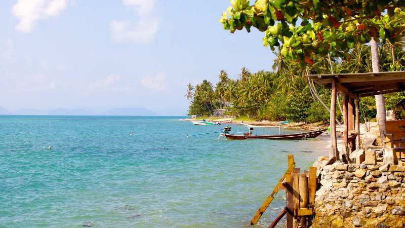
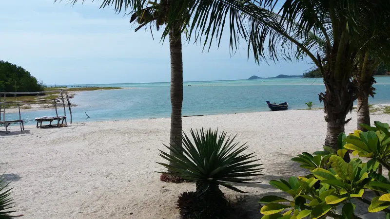
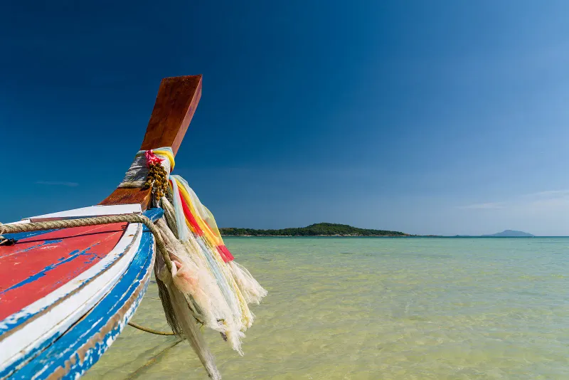
Phang Ka Beach (หาดพังกา), also written Ao Phang Ka, is a quiet, coconut-fringed bay tucked into the southwest corner of Koh Samui, Thailand, between Laem Hin Khom cape and the far end of Taling Ngam Beach. It is not a resort strip: it is a working local beach where longtail boats sit on the sand, a handful of family-run bungalows and guesthouses line the back shore, and the main event is a tide that pulls back so far it turns the bay into a flat, mirror-still expanse of wet sand.
Unlike Chaweng or Lamai on the east coast, Phang Ka sees very few tourists. There is no beach road lined with bars, no jet-ski touts shouting prices, and no queue for a sunbed. What draws people here instead is the view: west across the Gulf of Thailand toward a scatter of small islands, with some of the most reliable sunsets on Samui, and the sheer quiet of a beach still used for fishing more than photography.
Samui International Airport sits roughly 22 km northeast, about 45-50 minutes by car along the ring road and Route 4170. Taling Ngam Beach and the Conrad Koh Samui resort are a few minutes north; the small “Coral Islands” cluster is visible about 3 km offshore to the south.
History: A Fishing Cove Turned Quiet Bay
Phang Ka has never been a plantation-era resort beach in the way Chaweng or Bophut were. Its shallow, mud-flecked bay was of limited use for large boats, so the small communities settled here stayed focused on near-shore fishing, coconut farming, and, more recently, small-scale tourism built around longtail boat charters to nearby islands.
The name itself is descriptive rather than legendary: “Phang” refers loosely to the bay’s split or notched shoreline, and local guides simply call it the beach behind Taling Ngam’s southern headland. Older maps and some tour operators still label the immediately adjacent stretch Thong Tanote Beach, and the two names are often used interchangeably for what is really one long, shallow curve of coast.
Development arrived late: and lightly
Because the southwest corner of Koh Samui was harder to reach than the east coast, large-scale hotel development came decades later here than at Chaweng. Even today, the area is sometimes called Samui’s “Virgin Coast.” The Conrad Koh Samui opened on the cliffs above the bay in the 2010s, bringing international five-star tourism to the area for the first time, but it sits on a headland without direct beach access to Phang Ka itself. On the sand, the scene has stayed close to what it was a generation ago: fishing boats, a few family guesthouses, and coconut palms leaning toward the water.
The Beach: Layout and the Long Low Tide
Phang Ka’s defining feature is its shape and its tide, not its sand quality. The bay is almost square when seen from above, backed by roughly ~500-600 m of beach running from south to east, framed by green headlands on both sides.
Sand and water
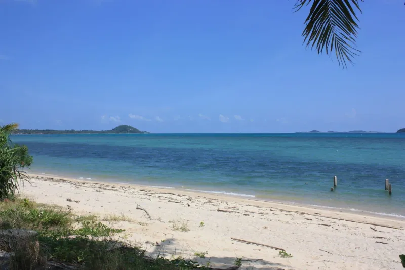
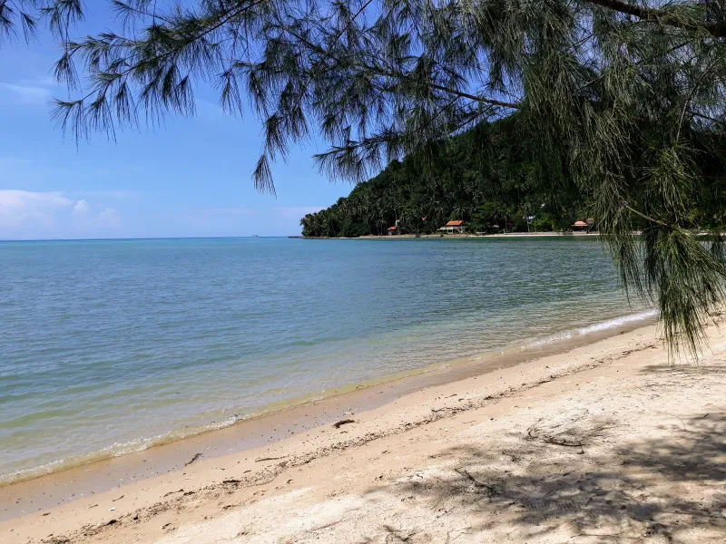
The sand nearest the tree line is light brown and noticeably coarse; it turns finer and paler closer to the water. Because the seabed is exceptionally flat, there are essentially no waves here at any state of the tide: the bay is naturally sheltered rather than surf-friendly.
The low-tide flat
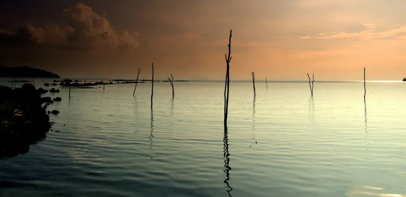
At low tide, the water can retreat across an exposed sandy and muddy plain that locals and guidebooks put at up to ~700 m before you reach swimmable depth. This is one of the longest tidal walks on the island, and it is the reason some guides describe Phang Ka as “a pit without water” at certain hours. It is also what makes the bay so photogenic: wide, wet sand throwing back the colors of a Gulf of Thailand sunset.
Swimming reality check
Phang Ka is not a reliable swimming beach. At mid to low tide, water depth near shore can be a few centimetres over a wide area; at high tide, swimming is possible but the bottom stays soft and slightly muddy in patches. If your priority is a swim-up beach, Lipa Noi or Taling Ngam a short drive north offer steadier water; if your priority is a long barefoot walk on an empty tidal flat at sunset, Phang Ka delivers something most other Samui beaches cannot.
Activities and Water Sports
Despite the tricky swimming conditions right off the sand, Phang Ka is set up as a small water-sports base: mostly for guests heading out toward deeper water and the islands offshore.
- Longtail boat hire: The classic local option. Boats can be chartered for coastal trips or island runs; expect to negotiate, with half-day charters typically in the ~1,500-3,000 THB (~43-86 USD) range depending on distance.
- Kayaking and paddleboarding: Some guesthouses and beach operators rent kayaks and SUP boards, best used at higher tide when there is enough water to paddle.
- Jet skis and speedboats: Available seasonally through beach-based operators, mainly for trips out toward the islands rather than joyriding in the shallow bay itself.
- Diving and snorkeling trips: Local operators run day trips from the beach to nearby reef spots; see the Coral Islands section below for the main destination.
- Beach walking and birdwatching: The exposed low-tide flat and adjacent mangrove patches attract wading birds, making an early-morning walk worthwhile even without swimming.
- Yoga: A small yoga retreat, Anandamaya, operates near the beach and offers drop-in classes for visitors staying nearby.
Coral Islands and Snorkeling
The main organized excursion from Phang Ka is a boat trip to the Coral Islands, a scatter of small islets roughly 3 km south of the bay that includes Koh Taen (Ko Tan), Koh Mat Sum, Koh Wang Nai, and Koh Rap. These islands sit outside the main Ang Thong Marine Park boundary but offer some of the more accessible fringing reef snorkeling near Samui’s south coast, with calmer water than the open sea further out.
Half-day and full-day snorkeling trips typically combine two or three of these islets, include mask and fin rental, and cost roughly ~1,000-2,000 THB (~29-57 USD) per person depending on the operator and whether lunch is included. Visibility is best in the dry season (December-April) when the sea is calmest.
Where to Eat
Dining around Phang Ka is limited and local: there is no beach-road restaurant strip here. Most food options are attached to the small guesthouses on the sand or the Conrad’s clifftop restaurants above the bay.
| Option | Type | Price Range | Known For |
|---|---|---|---|
| Beachfront guesthouse kitchens | Thai, simple seafood | $ | Grilled fish, rice dishes, fresh-caught catch of the day |
| Phangka Paradise Resort restaurant | Thai, Western | $-$$ | Casual open-air dining steps from the sand |
| Conrad Koh Samui restaurants | International fine dining | $$$-$$$$ | Clifftop sunset views, tasting menus |
| Taling Ngam village shops | Thai street food | $ | Noodle soups, som tam, basic grocery items |
Price guide
- Budget: Local Thai dishes at guesthouse kitchens, roughly 60-120 THB (~1.50-3.50 USD)
- Mid-range: Seafood plates at small beachfront restaurants, 150-350 THB (~4.50-10 USD)
- Upscale: Conrad Koh Samui dining, from around 1,500 THB (~43 USD) per person
For a wider choice of restaurants, most visitors drive 10-15 minutes north to Taling Ngam Beach or continue on toward Nathon.
Nearby Attractions
Phang Ka’s southwest position puts several quieter Samui landmarks within a short drive, though it is well outside the cluster of east-coast sights.
Under 15 minutes
- Taling Ngam Beach: A few minutes north along the coast road, with sweeping sunset views toward the Five Islands and Ang Thong Marine Park.
- Wat Khiri Mat: A hillside temple known locally as the “Golden Mountain of the West,” roughly 10-15 minutes by car.
- Mangrove patches: Small stands of mangrove line parts of the shore near Phang Ka and Taling Ngam, worth a look for birdlife at low tide.
Under 30 minutes
- Wat Kiri Wongkaram: Home to a preserved mummified monk displayed in a glass case, a well-known stop on the island’s west side.
- Laem Sor Pagoda: A striking golden chedi on the south coast shoreline, roughly 20-25 minutes away.
- Ang Thong National Marine Park boat departures: Some tour boats to the wider Ang Thong archipelago depart from piers accessible via the southwest coast road.
- Lipa Noi Beach: A calmer, more swimmable sunset beach further north on the west coast, a useful alternative for a beach day with the family.
Where to Stay
Accommodation directly on Phang Ka is limited to a handful of small properties, plus one international resort on the headland above the bay.
| Category | Average Price | Examples |
|---|---|---|
| Budget | 700-1,400 THB (~20-40 USD)/night | Small family-run guesthouses and bungalows on the beach road |
| Mid-range | 1,750-3,150 THB (~50-90 USD)/night | Phangka Paradise Resort, Solymar Villa |
| Luxury | 17,500-35,000+ THB (~500-1,000+ USD)/night | Conrad Koh Samui (clifftop, no direct beach access) |
Most visitors who want a full beach-resort experience with reliable swimming base themselves a short drive north in Taling Ngam or on the west coast around Lipa Noi, then treat Phang Ka as a half-day excursion for the low-tide walk, sunset, and island boat trips.
Getting There
From Samui Airport (USM)
Phang Ka is roughly 22 km southwest of the airport, about 45-50 minutes by car via the ring road and Route 4170.
- Airport taxi: Typically 600-800 THB (~17-23 USD), prepaid at the airport counter.
- Rental car or scooter: The most practical option given the beach’s distance from the main tourist strip; a scooter runs about 200-300 THB/day (~5.50-8.50 USD).
From other beaches
- From Chaweng: About 40 minutes by car (~450-550 THB by taxi).
- From Lamai: About 25 minutes by car (~300-400 THB by taxi).
- From Nathon (ferry port): About 20-25 minutes north along the coast road.
The final stretch
From the ring road, turn onto Route 4170 and follow signs toward Taling Ngam and Wat Khiri Mat, then continue past the Conrad Koh Samui turnoff toward the smaller side roads signed for Phangka Paradise Resort and Elements Boutique. The last section is narrow and best driven slowly, especially at night.
Best Time to Visit
| Season | Months | Conditions | Rating |
|---|---|---|---|
| Peak / Dry | Dec - Feb | Calm seas, best sunsets, clearest island visibility | ★★★★★ |
| Hot | Mar - May | Hot, generally dry, still good for boat trips | ★★★★ |
| Inter-monsoon | Jun - Aug | Mixed weather, seas usually manageable | ★★★ |
| Monsoon | Sep - mid-Nov | Rain more likely, choppier crossings to the islands | ★★ |
Phang Ka-specific notes
- Because Phang Ka is not primarily a swimming beach, tide timing matters more than season for a good visit: check tide tables and aim to arrive an hour or two before low tide for the dramatic flat, or at high tide if you actually want to wade in.
- The best sunsets typically fall in the dry season (December-April), when skies are clearest over the water to the west.
- Boat trips to the Coral Islands are least reliable in the September-November monsoon window, when operators may cancel due to swell.
Practical Tips
Essentials
- Tide tables matter here more than almost anywhere else on Samui: check them before planning a swim or a photo trip.
- Footwear: Reef shoes or sandals help on the low-tide flat, where the sand can be uneven and occasionally sharp with shell fragments.
- Shade: Tree cover is limited on the open flat; bring a hat and sunscreen if walking out at midday.
- Facilities: Very basic, a few small shops and guesthouse kitchens, no 7-Eleven directly on the beach. The nearest convenience stores are in Taling Ngam or along the ring road.
- Mobile signal: Generally reliable, though weaker than on the built-up east coast.
For families
Phang Ka works better as a scenic stop or a sunset walk than a full family beach day, since swimming windows are tide-dependent. Families wanting a swim-focused beach nearby should base at Taling Ngam or Lipa Noi and treat Phang Ka as a short excursion.
For photographers and quiet-seekers
This is Phang Ka’s strongest audience. The wide wet-sand mirror at low tide, the empty shoreline, and the unobstructed sunset over the Gulf of Thailand make it one of the more rewarding “undiscovered” spots on the island for anyone willing to check the tide chart first.
Who Is Phang Ka Best For?
| Traveler Type | Fit | Why |
|---|---|---|
| Photographers | ★★★★★ | Low-tide mirror flat, uncrowded sunset views |
| Couples seeking quiet | ★★★★★ | Very few visitors, remote feel, dramatic scenery |
| Families wanting to swim | ★★ | Tide-dependent water, better options nearby |
| Snorkelers / boat-trip fans | ★★★★ | Gateway to the Coral Islands, longtail charters |
| Party seekers | ★ | No nightlife, no bars, no beach clubs |
| Digital nomads | ★★ | Very limited infrastructure and cafes |
| Luxury travelers | ★★★★ | Conrad Koh Samui sits directly above the bay |

FAQ
Is Phang Ka Beach good for swimming?
Not reliably. Phang Ka’s seabed is extremely flat, so at low to mid tide the water can be only centimetres deep across a wide area, and the sand stays slightly muddy in patches. Swimming is more feasible at high tide. For dependable swimming, nearby Taling Ngam or Lipa Noi beaches are better choices.
Where exactly is Phang Ka Beach on Koh Samui?
Phang Ka Beach sits on Koh Samui’s southwest coast, between Laem Hin Khom cape and the southern end of Taling Ngam Beach, roughly 22 km (~45-50 minutes) from Samui International Airport. It is sometimes labeled Thong Tanote Beach on older maps and by some tour operators.
What is the low-tide flat at Phang Ka Beach?
At low tide, the shallow bay at Phang Ka Beach exposes a sandy and muddy plain that can stretch up to ~700 m before reaching swimmable depth. This creates a mirror-like reflective surface, popular for photography and sunset walks, though it makes a quick swim impractical at that stage of the tide.
How do you get to the Coral Islands from Phang Ka?
Local operators run longtail boat and snorkeling day trips from Phang Ka Beach out to the nearby Coral Islands, including Koh Taen and Koh Mat Sum, about 3 km offshore. Half-day trips typically cost ~1,000-2,000 THB (~29-57 USD) per person and run most reliably in the December-April dry season.
Is there a resort right on Phang Ka Beach?
The Conrad Koh Samui sits on the cliffs above Phang Ka Bay but does not have direct beach access to the sand below. On the beach itself, accommodation is limited to smaller guesthouses and mid-range properties such as Phangka Paradise Resort, giving the area a much quieter feel than Samui’s east-coast resort strips.
About the author

Mike Brochlowski
Travel photographer & writer
Travel photographer and island explorer. Mike has spent years documenting Southeast Asia's hidden gems, from secluded beaches to jungle waterfalls.
Articles by Mike →