Contents
Overview
The Samui 360 Viewpoint Trail climbs from the golden Phra Buddha Dipankara statue at Wat Teepangkorn to the highest panoramic lookout on Koh Samui, on the summit ridge of Khao Pom. It’s a 4.3 km round trip on mixed paved road and dirt path, gaining about 426 meters, and it takes most hikers 2 to 2.5 hours out and back. Unlike the island’s deep-jungle expeditions, no guide is required: this is a well-documented route with an AllTrails page and a steady trickle of visitors, yet it still delivers the single best 360-degree view on the island.
The trail sits in Koh Samui’s central interior, well above the coastal resorts and traffic. Because it follows the same access corridor used by jeep tours and the temple itself, hikers share the road with the occasional 4x4 and motorbike, but the walking experience, especially on the upper dirt sections, feels remote and quiet.
Key Facts: 4.3 km round trip (~2.7 mi) · ~426 m elevation gain (~1,397 ft) · 2-2.5 hours · Moderate difficulty · Out-and-back · Starts at the Phra Buddha Dipankara statue, Wat Teepangkorn · Free entry (donation ~20-40 THB) · Best 8:00-9:30 AM or sunset
Trail Details
| Stat | Detail |
|---|---|
| Total distance | 4.3 km round trip (~2.7 mi) |
| Elevation gain | ~426 meters (~1,397 ft) |
| Time | 2-2.5 hours out and back |
| Difficulty | Moderate |
| Trail type | Out-and-back, paved road + dirt path |
| Rating | ~4.1/5 from AllTrails reviewers |
| Starting point | Phra Buddha Dipankara statue, Wat Teepangkorn |
| Ending point | Samui 360 viewpoint, Khao Pom summit ridge |
| Access | 4x4, motorbike, or on foot from the temple gate |
This trail is distinct from a scooter drive straight to the temple car park. Many visitors ride a 4x4 or motorbike up the steep access road and stop at Wat Teepangkorn itself; the hiking route described here continues on foot past the statue, following the road and connecting dirt paths further uphill to the actual 360-degree lookout point beyond the main temple terrace.
The Trailhead: Phra Buddha Dipankara Statue
The hike begins at the towering Phra Buddha Dipankara (also transliterated Phra Buddha Teepangkorn), the golden standing Buddha statue that anchors the Wat Teepangkorn complex. Reviewers note the parking area here is easy and spacious, even though the drive up is not. Take a moment at the statue’s base (a small plaza ringed with dozens of temple bells that locals ring in sequence for good luck) before continuing on foot.
Because the statue sits on active temple grounds, dress modestly: shoulders and knees covered, as at any Thai wat. It’s a working religious site, not just a viewpoint, and it’s still under active expansion, so expect some construction activity around the edges.
The Climb: Access Road and Jungle Path
From the statue, the trail continues upward along a mix of paved concrete road and narrower dirt track. AllTrails reviewers consistently flag the same two things: the access road is steep in sections (locals describe gradients over 30% in places), and the trail rewards the climb with beautiful views from multiple directions along the way, not just at the very top.
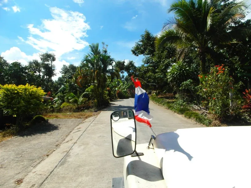
The lower stretch is mostly concrete, built to support vehicle traffic to the temple. As the route climbs past the main temple terrace, it narrows into dirt path, weaving through patches of forest and open, wind-exposed ridge. Footing is generally solid in dry weather but turns slick and occasionally treacherous when wet: the same warning that applies to the vehicle road applies doubly to hikers on foot.
Plantations and Jungle Along the Way
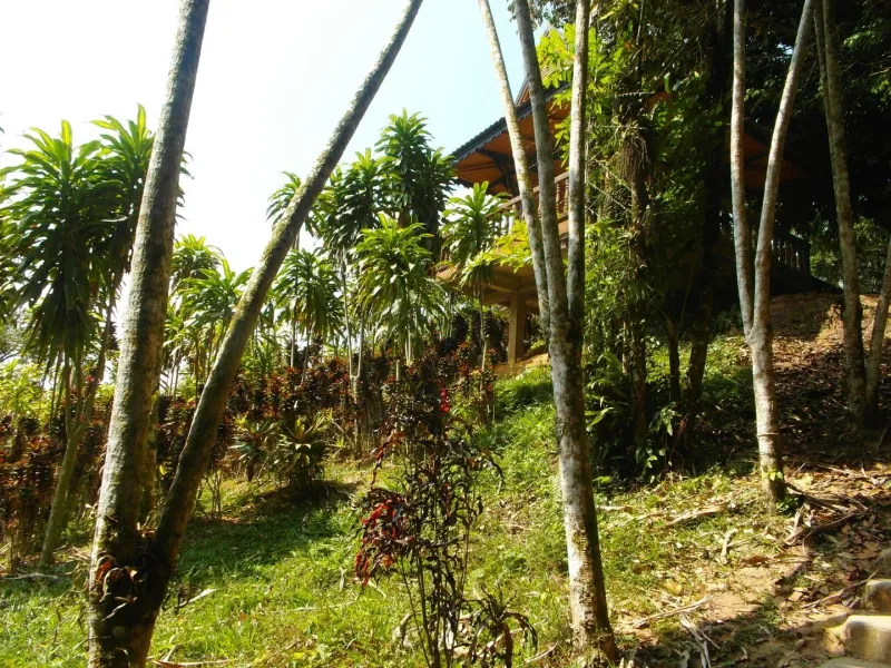
One of the trail’s quieter pleasures is what it passes through rather than what it ends at. The route winds past small stands of durian, coconut, and banana under cultivation: a reminder that Koh Samui’s mountainous interior has been farmed for generations, long before the coast filled with resorts. Between plantation plots, the path ducks into short bands of forest offering shade and a break from the sun before opening onto exposed ridge again.
This mix of cultivated land and forest is part of what separates the Samui 360 Viewpoint Trail from a true jungle expedition: it’s a working landscape with a visible human footprint, which is exactly why it doesn’t require a guide the way a route through unmarked primary rainforest would.
The Summit: Samui’s 360-Degree Viewpoint
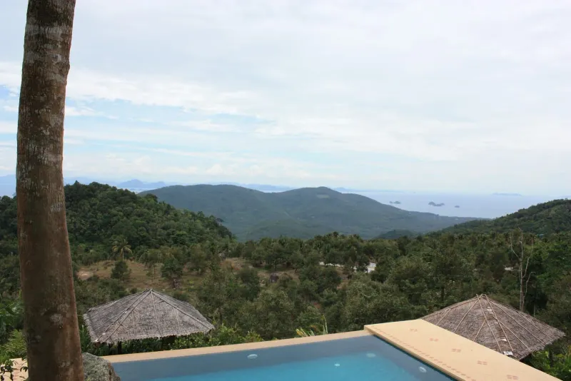
The payoff is the view. From the upper terraces near Khao Pom’s summit ridge, the panorama genuinely lives up to the name: on a clear day you can pick out Chaweng and Lamai’s turquoise crescents to the east, the airport runway and Bophut toward the north with Koh Phangan visible offshore, the limestone peaks of Ang Thong Marine Park to the west, and an unbroken carpet of coconut groves filling the interior to the south. It’s the only spot on Koh Samui where you get a genuine aerial-style view of the coastline without a drone.
The summit also carries a working venue: Jungle Route 360, a restaurant and campsite reached from the other side of the mountain by vehicle. Hikers on this trail arrive at the same terrace on foot; drivers reach it by the access road covered on that page.
Reviewers rate the trail around 4.1 out of 5, citing the views from every direction as the highlight, alongside easy parking at the base. The two most common complaints are the steep access road and restrooms at the top that aren’t always well maintained, minor tradeoffs for the payoff.
Wat Teepangkorn and the Discovery Museum
The temple you pass through on the way up is worth its own stop, not just a waypoint. Wat Teepangkorn houses the Watlamai Discovery Museum, a small multi-story building with an eclectic collection of old farming tools, historical photographs, and religious relics documenting the island before tourism. Its rooftop deck is, by many accounts, the single best formal viewpoint on Samui: a slightly more developed alternative to continuing further up the dirt trail to the open summit ridge.
Combining the temple, museum, and the extended hike to the summit viewpoint makes for a satisfying half-day outing: culture and history at the base, physical effort and open-air scenery above it.
How Is This Different from the Khao Pom Summit Trek?
Because both routes involve Khao Pom, it’s easy to confuse this hike with the Khao Pom Summit Trek, and they are genuinely different experiences:
| Samui 360 Viewpoint Trail | Khao Pom Summit Trek | |
|---|---|---|
| Distance | 4.3 km round trip | ~8 km round trip |
| Time | 2-2.5 hours | 4-6 hours |
| Surface | Paved road + dirt path | Unmarked primary rainforest |
| Guide needed | No | Yes, required |
| Difficulty | Moderate | Challenging |
| Access | Vehicle-accessible road most of the way | No vehicle access; jungle only |
In short: the Samui 360 Viewpoint Trail is the accessible, well-trodden way to get a spectacular view of the island in half a day without a guide. The Khao Pom Summit Trek is a genuine wilderness expedition into untouched forest for hikers who want something far more demanding. Both end up near the same mountain, but they are not interchangeable: don’t expect the viewpoint trail’s road access on the summit trek, and don’t expect the summit trek’s remoteness on the viewpoint trail.
Getting There
The trailhead shares its access point with Wat Teepangkorn. The most common route starts from the road opposite Wat Khunaram in the south of the island, following signs first for “Secret Garden,” then for “Teepangkorn” or “360 View” all the way to the temple gate and statue.
| Starting Point | Drive Time to Trailhead | Notes |
|---|---|---|
| Lamai | ~15-20 min | Closest major beach town |
| Nathon | ~20-25 min | Via the southern interior road |
| Chaweng | ~30-35 min | Longer but doable by scooter |
| Bophut | ~35-40 min | Via the Jungle Route 360 turnoff |
By 4x4: The most comfortable option, and how most jeep safari tours reach the temple. By motorbike: Only for confident, experienced riders: the road is steep, narrow, and partly unpaved near the top, and standard rental scooters can struggle on the climb. On foot: Possible from the base of the access road if you want to hike the full elevation gain, though most visitors drive or ride to the temple and hike the final stretch to the summit viewpoint on foot.
Best Time to Hike
| Time | Conditions | Rating |
|---|---|---|
| 8:00-9:30 AM | Coolest air, often above the morning mist, quietest | ★★★★★ |
| 11:00 AM-3:00 PM | Clearest coastal visibility, but intense sun | ★★★★ |
| 5:00 PM-sunset | Golden-hour light, best for western views over Ang Thong | ★★★★★ |
| During or after heavy rain | Slippery road and path, poor visibility: avoid | ★ |
Seasonally, the dry months from December through August give the most reliable footing and clearest long-distance views. Avoid attempting the hike during or immediately after heavy monsoon rain, when the access road and upper dirt path become genuinely hazardous.
For trail conditions and recent hiker reports, the route is documented on AllTrails under the name Pra Buddha Dīpankara: Samui Viewpoint. General background on the island’s geography is available on Wikipedia’s Ko Samui entry.
What to Bring and Safety Tips
- Sturdy closed shoes with grip: the dirt sections near the top are uneven and can be loose underfoot.
- Water, at least 1 liter: there’s little shade on the exposed upper ridge and the tropical sun is intense.
- A light jacket or windbreaker: it’s noticeably cooler and windier up at the ridge than at sea level.
- Modest clothing: shoulders and knees covered for the temple sections at the start.
- Sun protection: hat and sunscreen; much of the upper trail is unshaded.
- Cash: a small donation (~20-40 THB) is customary at the temple, and food/drink stalls near the base are cash-only.
Safety notes: Check the weather before setting out: rain makes both the vehicle access road and the upper dirt path slick and, in places, dangerous. If riding a motorbike to the trailhead, know your limits; this road is not for first-time scooter riders. Carry a phone with an offline map or the AllTrails route saved in advance, since signal can be patchy on the upper mountain.
Nearby Attractions
Combine the hike with these interior sites, all within a short drive of the trailhead:
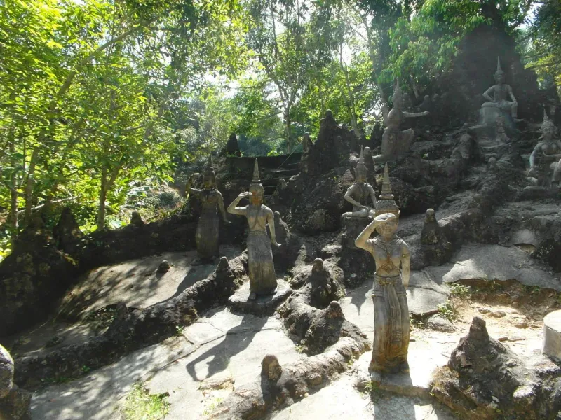
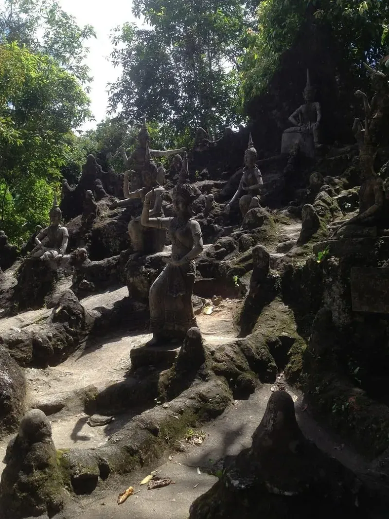
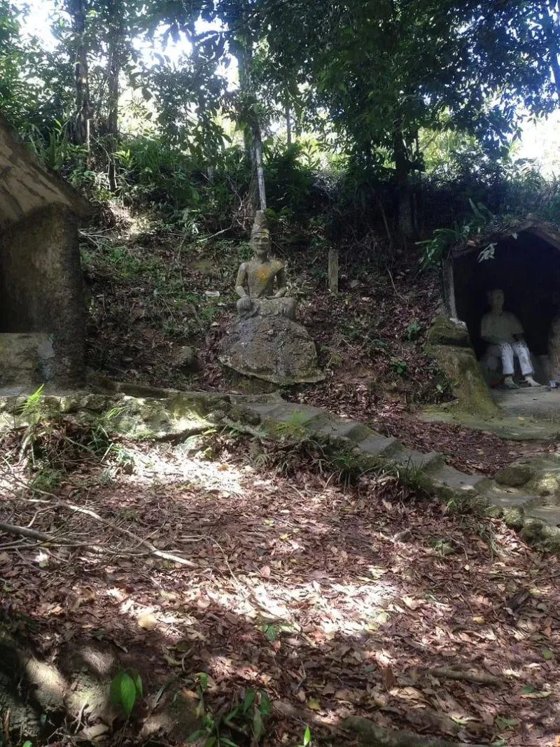
- Secret Buddha Garden: a surreal collection of statues set among a mountain stream, further down the same access road.
- Wat Khunaram: home to the mummified monk Luang Pordaeng, and the landmark turnoff for the road up to the trailhead.
- Jungle Route 360: the restaurant and campsite standing on this same summit, reached from the other side by vehicle rather than on foot.
Who Is This Trail Best For?
| Hiker Type | Fit | Why |
|---|---|---|
| View seekers | ★★★★★ | The single best panoramic viewpoint on Koh Samui, reached without a guide |
| Moderate-fitness hikers | ★★★★★ | 4.3 km and ~426 m gain is a real workout without requiring technical skill |
| Photographers | ★★★★★ | 360-degree views, golden-hour light, and temple architecture in one trip |
| Families with older kids | ★★★ | Doable but the elevation gain and sun exposure suit kids 10+ |
| First-time motorbike riders | ★★ | The access road is genuinely demanding; consider a 4x4 or taxi instead |
| Budget travelers | ★★★★★ | Free hiking, small temple donation, cheap parking |
| Adventure seekers wanting true wilderness | ★★★ | Consider the Khao Pom Summit Trek instead for a guided jungle expedition |
FAQ
How long is the Samui 360 Viewpoint Trail?
The trail is 4.3 km round trip (~2.7 mi) with approximately 426 meters of elevation gain, taking most hikers 2 to 2.5 hours out and back. It starts at the Phra Buddha Dipankara statue at Wat Teepangkorn and climbs to the summit viewpoint on the Khao Pom ridge.
Do I need a guide for this hike?
No. Unlike the deep-jungle Khao Pom Summit Trek, the Samui 360 Viewpoint Trail follows a marked, vehicle-accessible road and connecting dirt paths with a documented AllTrails route. Reasonable fitness and proper footwear are all that’s required.
Is the road to the trailhead dangerous?
The access road is steep, narrow, and partly unpaved, with gradients reportedly exceeding 30% in places. It’s manageable by 4x4 or an experienced motorbike rider but genuinely difficult for first-time scooter riders, especially in wet conditions. Many visitors hire a driver or join a jeep tour instead.
Is there an entry fee?
The hike itself is free. A small donation of around 20-40 THB is customary to support Wat Teepangkorn, which sits at the trailhead and is still expanding.
What’s the best time to hike to the Samui 360 viewpoint?
Early morning between 8:00 and 9:30 AM offers the coolest temperatures and clearest air, often above the morning mist. Late afternoon near sunset gives dramatic golden-hour light over the western coastline. Avoid hiking during or right after heavy rain, when the road and path become slippery.
Can I combine this hike with other attractions?
Yes. The Secret Buddha Garden and Wat Khunaram sit along the same access road, and Jungle Route 360 is a short detour away, making it easy to build a half-day interior itinerary around the hike.
Published Updated
About the author
Samui69 Editorial Team
Editorial team
Guides researched and fact-checked by the Samui69 editorial team: residents and frequent visitors who verify opening hours, prices and directions on the ground.
About the author →More in Hiking

2.4 km away
Secret Buddha Garden: Nim's Mystical Jungle Sanctuary
Discover the Secret Buddha Garden (Tarnim Magic Garden) in Koh Samui's interior.
2.5 km away
Sleeping Buddha Trail: Koh Samui's Hidden Jungle Trek
Hike the Sleeping Buddha Trail on Koh Samui: a ~90 minute moderate jungle trek beyond the Magic Garden to a golden reclining Buddha deep…
Next in Hiking
Secret Buddha Garden Trail: Jungle Hike to Nim's Statues
Hike the Secret Buddha Garden Trail on Koh Samui: a ~1-2 hour jungle climb up Pom Mountain to Nim Thongsuk's 80+ moss-covered statues and…