Contents
Overview
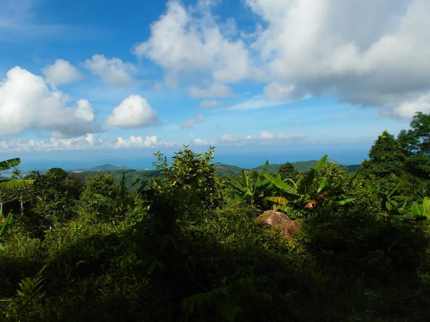
Jungle Route 360 is a small mountain restaurant and campsite standing on Koh Samui’s second-highest summit, in the island’s central highlands above Bo Phut and Lamai. It has operated since 2015, and the reason people make the drive is straightforward: from the open deck, the view genuinely runs most of the way around the compass, taking in Lamai, Chaweng and Choeng Mon on the coast, Koh Phangan and Koh Tao out in the Gulf of Thailand, and the scattered limestone islands of Ang Thong Marine Park on a clear day. Entry itself is free; ordering food or a drink at the restaurant is the expected cost of stopping, and overnight camping is available on site for anyone who wants the same view at sunset, after dark, and again at sunrise.
Key facts: Elevation ~585 m (SRTM/OpenStreetMap; the venue’s own materials say up to ~615 m) · Open daily, roughly 08:00–17:00 · Free entry, food or drink expected · Camping available on site · ~20 min drive from the Lamai 7-Eleven turn, road partly unpaved · Open since 2015
History — A Restaurant Since 2015
Jungle Route 360 is a privately run business, not a temple or a public park, and its history is short and mostly practical: the owners cleared and built a platform on the mountainside in 2015 and have operated a restaurant there ever since. It has grown into something closer to a small off-grid outpost than a simple roadside stop — solar panels supply the electricity, waste is sorted on site, and organic scraps are composted and used to grow vegetables and fruit for the kitchen. None of this is heavily marketed; it comes up mainly in visitor accounts and reviews rather than on a formal sustainability page, but it is consistent enough across sources to note.
The name reflects what getting there involves as much as what’s on offer once you arrive — “jungle route” is a fair description of the drive up, and “360” refers to the promised field of view from the top. It sits close to, but is administratively and functionally separate from, Wat Teepangkorn, the Buddhist temple a few minutes back down the mountain that most visitors pass on the way.
The Summit — Koh Samui’s Second-Highest Peak
Jungle Route 360 stands on Koh Samui’s second-highest summit. The claim isn’t just a marketing line: it’s repeated independently across several travel write-ups going back to at least 2018, and it holds up against the island’s known topography. The true highest point on Samui is Khao Pom, at 635 meters, roughly 2.6 km to the southwest and reachable only via the unmarked jungle route covered on our Khao Pom Summit Trek page — a genuine wilderness hike that needs a local guide. Jungle Route 360’s summit is the next ridge over, lower than Khao Pom but open, developed, and far easier to reach.
This is also the same summit reached by the Samui 360 Viewpoint Trail, the 4.3 km hiking route that climbs from the golden Buddha statue at Wat Teepangkorn. That trail’s endpoint and Jungle Route 360’s terrace are the same place: the hiking page describes the walk up through the temple grounds and jungle path, and this page describes the restaurant and campsite that’s actually standing there at the top. If you arrive on foot via the trail, you’ll find Jungle Route 360’s tables and camping ground waiting for you; if you drive up, you’re taking the vehicle track that runs roughly parallel to the same hillside. Either way, the two pages describe two sides of one place — read the trail page for the hike itself, and this page for what’s at the summit when you get there.
On elevation, the numbers genuinely disagree. Satellite elevation data (SRTM, echoed by OpenStreetMap’s viewpoint node at this exact coordinate pair) puts the summit at approximately 585 meters. Separately, the venue’s own social media and one aggregator have quoted figures between 613 and 615 meters for the restaurant’s platform. Since satellite measurement is the more reliable source, this page uses “about 600 meters” or the SRTM figure of 585 meters, rather than the higher, self-reported number. This site’s own viewpoints hub prints a third figure, about 595 meters, for the same coordinates — a Copernicus DEM sample read from a terrarium-encoded terrain tileset at zoom 12 (roughly 18.85 m per pixel) with no observer height added; like the other two, it hasn’t been checked on the ground.
The View, Direction by Direction
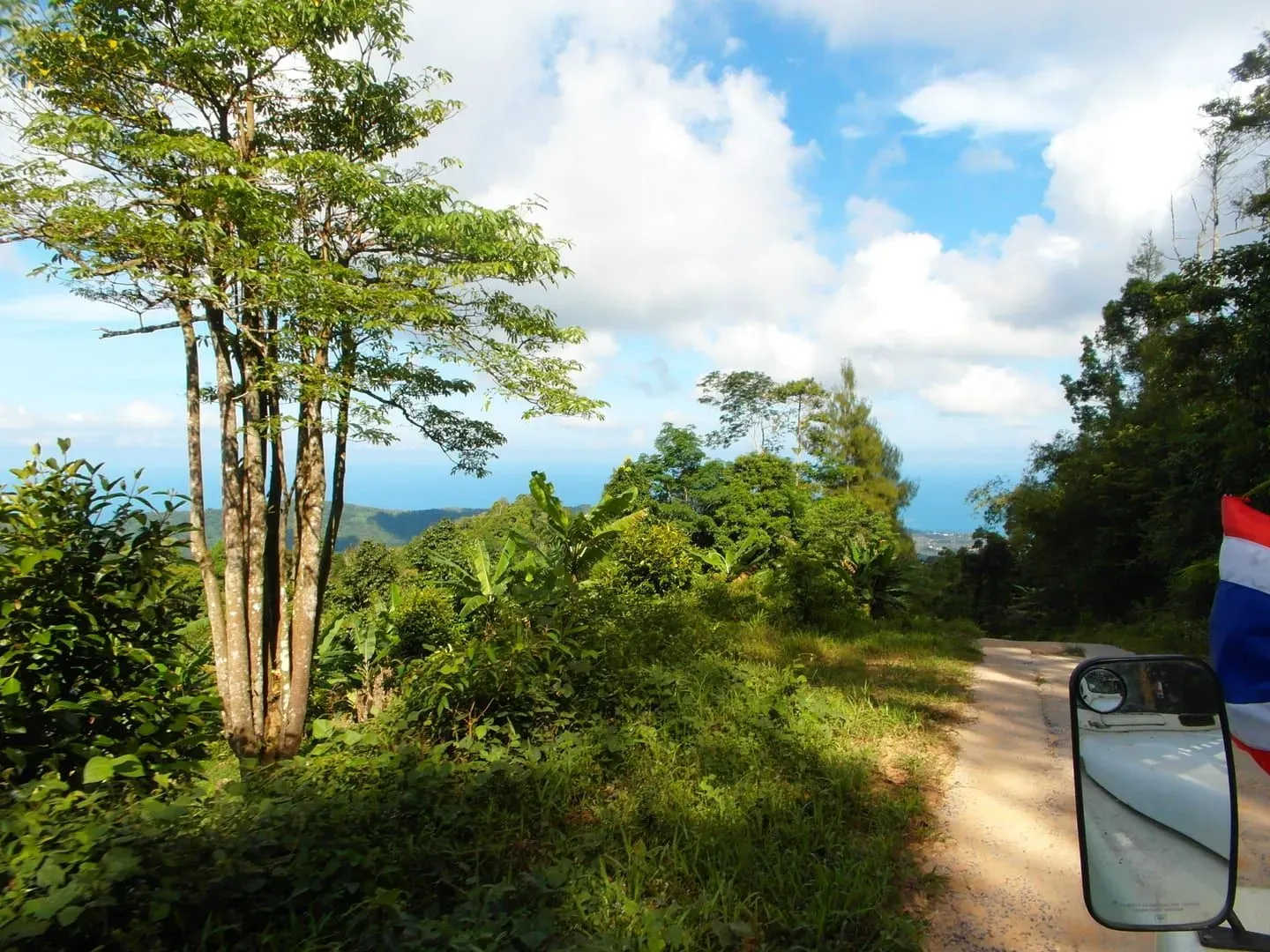
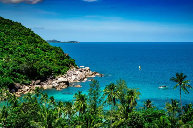
What makes Jungle Route 360 worth the drive is that the summit is genuinely open on most sides, not screened by taller ridges or forest canopy the way many of Samui’s high points are. On a clear day, here’s roughly what’s where:
- East to southeast: the long curve of Lamai’s bay sits almost directly below and slightly south, with Chaweng further along the coast to the east-northeast — both visible as a strip of pale sand against the turquoise shallows.
- North-northeast: Choeng Mon and the coastal stretch around the airport corridor, with aircraft occasionally visible on approach or departure.
- North: across the strait, the hills of Koh Phangan rise out of the Gulf of Thailand, close enough to make out its coastline in clear conditions.
- North-northwest: Koh Tao, further out and smaller on the horizon, visible mainly when humidity is low.
- Northwest: the scattered limestone islands of the Ang Thong Marine Park archipelago, sitting low against the sea; on the very clearest days, the Thai mainland coast toward Khanom is reportedly visible as a hazy line beyond them, though this isn’t something every visitor will see.
- West to southwest: Koh Samui’s own forested interior, including the true summit of Khao Pom rising slightly higher on the neighboring ridge, and the temple terrace of Wat Teepangkorn lower down the same mountainside.
None of this is guaranteed — Samui’s interior generates its own local cloud and haze, especially by mid-morning, and the “360-degree” framing describes the geometry of the open deck rather than a promise of visibility in every direction on every visit. Early morning, right after the air has been washed clean by an overnight shower, tends to give the clearest and longest sightlines.
Camping on the Mountain
Overnight camping at Jungle Route 360 is one of its more distinctive features among Samui’s viewpoints — most of the island’s lookouts are day-use only, but here you can stay through sunset, watch the sky over the Gulf of Thailand after dark, and be in place for sunrise without an early drive up the unpaved access road. Multiple independent accounts confirm camping is available on site, though none of the sources this page draws on specify current tent rental costs, group size limits, or exactly what’s supplied versus what campers need to bring — treat these as details to confirm directly with the venue rather than assume. Given the setup (solar power, an on-site restaurant, and staff present through closing), a reasonable expectation is that campers can eat on site and won’t be entirely off-grid, but this isn’t a fully serviced campground with marked pitches.
Food, the Pool and the Eco-Setup
The restaurant serves Thai food, and reviewers consistently single out the cooking as better than the roadside setting might suggest — garlic beef comes up repeatedly as a highlight, alongside fresh coconuts and, per one nearby write-up, a fried rice served in a hollowed pineapple. Expect simple Thai staples rather than an extensive menu; this is a working kitchen on a mountain with solar power and no easy supply road, not a resort restaurant.
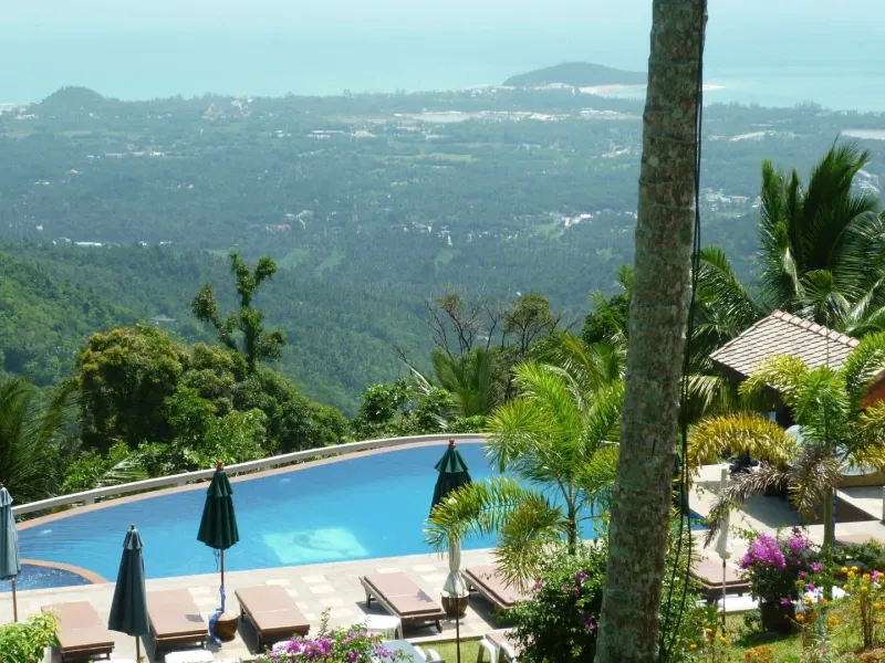
Beyond the food, there’s a small infinity-style pool at the top that costs around 100 THB (~3 USD) to use — a way to cool off after the climb up, with the view doubling as the pool’s main feature. The site also has swings and simple photo backdrops built into the terrace, which show up often in visitor photos and social posts. As noted above, the operation runs on solar electricity, sorts its waste, and composts organic scraps into an on-site garden — a genuinely lower-impact setup than most hilltop businesses on the island, even without any formal certification attached to it.
The Road Up
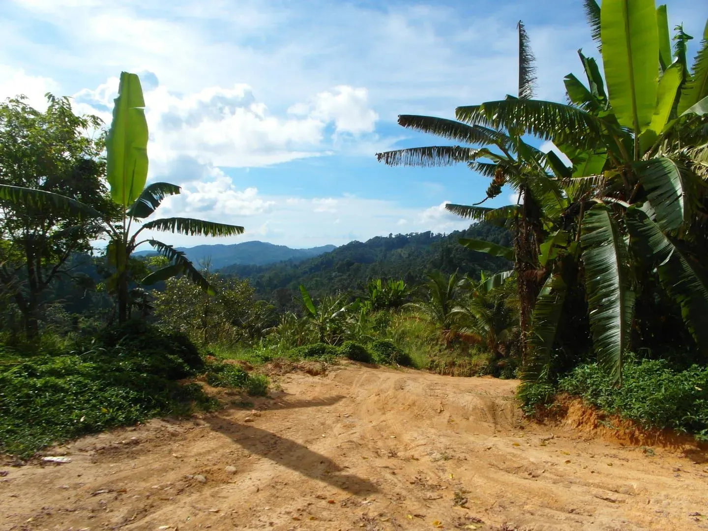
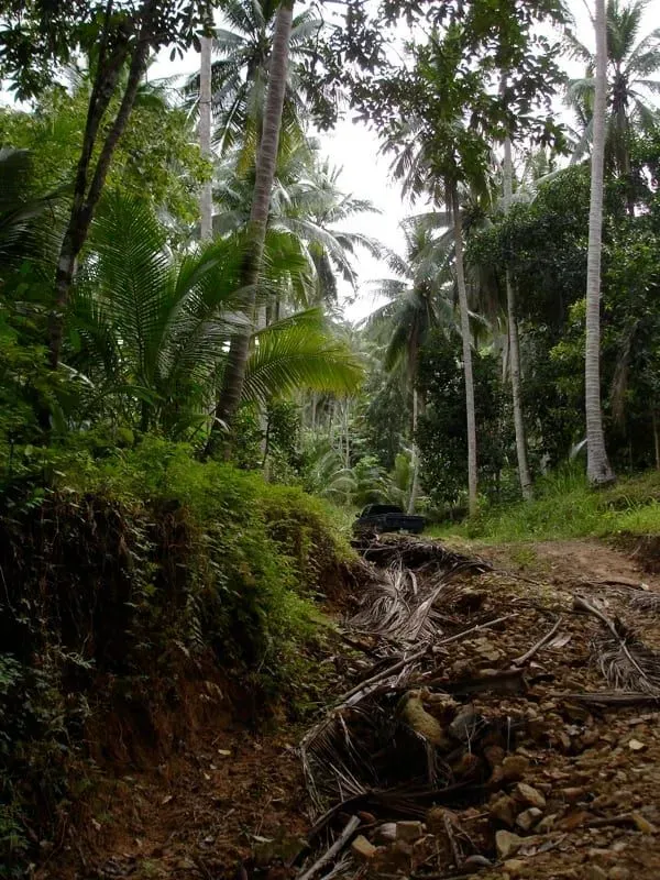
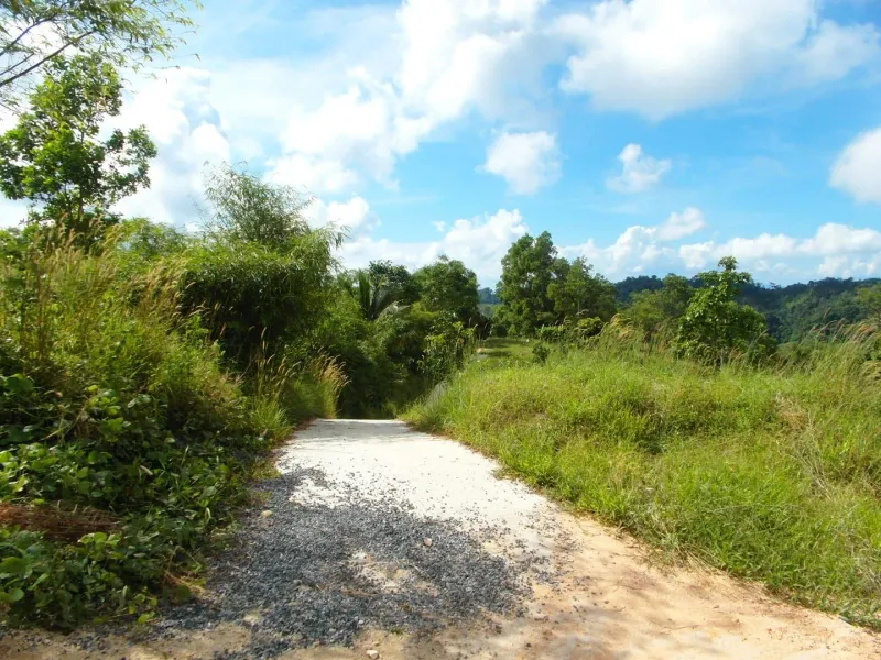
Getting to Jungle Route 360 is as much a part of the experience as the summit itself, and it’s worth planning for rather than treating as an afterthought. The access road is a mix of concrete and unmade mud track, climbing steeply through jungle on a narrow, winding route. Multiple reviewers describe it as genuinely demanding: a 4x4, ATV, or motocross-style bike copes with it, while an ordinary rental car or a small automatic scooter is likely to struggle, particularly on the steepest and least paved sections. If you’re riding a bike up, bring water — not just to drink, but to cool your brakes on the way back down, since sustained braking on the steep descent can cause them to overheat.
This is the vehicle route; it isn’t the only way up. Hikers can instead follow the Samui 360 Viewpoint Trail on foot from Wat Teepangkorn, a 4.3 km round trip that avoids the driving hazards entirely in exchange for two to two-and-a-half hours of walking. Which approach makes more sense depends on whether you’d rather manage a rough road or a moderate hike to reach the same summit.
Getting There
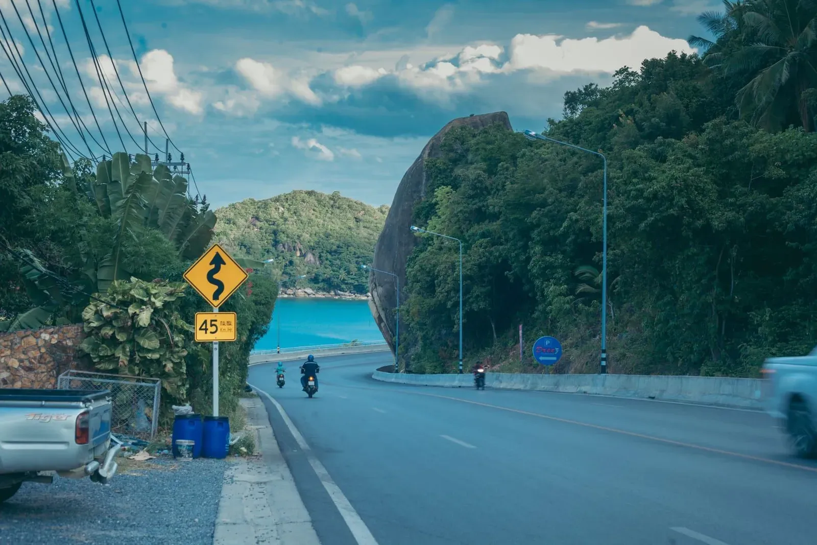
Most directions start from Lamai: turn off near the Lamai 7-Eleven and head up into the hills, following signs toward Wat Teepangkorn and continuing past the temple onto the rougher track that leads to the summit. The drive from that turn takes roughly 20 minutes, most of it climbing, with the final stretch on the unpaved section described above. From Wat Teepangkorn itself, Jungle Route 360 is only a few minutes further up the mountain — close enough that many visitors combine a stop at the temple and museum with the drive to the restaurant on the same trip.
There’s no metered taxi fare readily available for this route, since it’s off the standard tourist circuit; most visitors arrive by rented scooter, ATV, or a private 4x4 arranged through a driver or guesthouse, rather than by flagging down a taxi.
Best Time to Visit
Jungle Route 360 is open daily, roughly 08:00 to 17:00, though hours reported across sources vary by an hour in either direction — treat the posted opening and closing times as approximate and allow buffer either side. One recurring piece of visitor advice is to arrive after about 13:45, once the day’s tour groups and jeep safaris have typically moved on, for a quieter deck and easier access to a table. For the clearest views, the cool, dry season from roughly December to February tends to offer the best visibility, since Samui’s interior haze builds up more in the hot season and rain reduces sightlines and makes the unpaved access road harder going during the monsoon months (typically October–November).
If you’re camping overnight, sunrise is the reward: with no early drive required, you’re already in place when the sky over the Gulf of Thailand starts to lighten.
Practical Tips
- Free entry is the standing arrangement, though at least one 2026 Tripadvisor review reported being charged a small per-person or per-motorcycle fee on arrival — worth having some cash on hand in case policy has changed or varies by visit.
- Bring cash. There’s no indication of card payment being reliably available this far up the mountain.
- Choose your vehicle carefully. A 4x4, ATV, or larger motorbike handles the access road far better than a small scooter or a standard rental car.
- Cool your brakes on the way down. The steep, sustained descent can overheat motorbike brakes; carrying water to pour over them is a commonly repeated tip.
- The pool costs extra — roughly 100 THB (~3 USD) — and is optional, separate from the free entry.
- Weather matters more than usual here. Rain turns the unpaved sections to mud and can also reduce visibility to close to zero, defeating the point of the trip.
- If hiking instead of driving, budget the full 4.3 km round trip and 2–2.5 hours the Samui 360 Viewpoint Trail page describes, rather than treating it as a short walk.
Nearby Attractions
- Wat Teepangkorn — the temple and trailhead a few minutes back down the mountain, with its own golden Buddha statue and small museum; most drivers and hikers pass through here on the way up.
- Samui 360 Viewpoint Trail — the 4.3 km hiking route up to this same summit from Wat Teepangkorn, for anyone who’d rather walk than drive the rough road.
- Khao Pom Summit Trek — the unmarked, guide-required jungle route to Samui’s actual highest point, visible from Jungle Route 360’s deck on the neighboring ridge.
- Lamai Beach — the coastal town and beach where most drivers turn off to start the climb, and a natural place to end the day after coming back down.
Who Is Jungle Route 360 Best For?
| Traveler Type | Fit | Why |
|---|---|---|
| Photographers | ★★★★★ | A genuinely wide, open horizon rarely matched elsewhere on Samui |
| Campers / overnight travelers | ★★★★★ | One of the few Samui viewpoints where staying overnight is an option |
| Off-road / scooter riders | ★★★★ | The rough access road is part of the appeal for confident riders |
| Hikers | ★★★★ | Reachable on foot via the Samui 360 Viewpoint Trail from Wat Teepangkorn |
| Casual tourists in a rental car | ★★ | The unpaved sections make an ordinary car a poor fit |
| Anyone chasing a guaranteed view | ★★★ | Haze and cloud can blank out the “360-degree” view on a hazy day |
FAQ
Is Jungle Route 360 the same as the Samui 360 Viewpoint?
Yes, effectively. Jungle Route 360 is the restaurant and campsite standing on the same summit that the Samui 360 Viewpoint Trail climbs to from Wat Teepangkorn. If you hike the trail, you arrive at this restaurant; if you drive up the access road, you reach the same point from the other direction.
How much does it cost to visit Jungle Route 360?
Entry is generally free, with food or a drink at the restaurant the expected cost of stopping. At least one 2026 review reported a small entrance fee being charged, so bring cash in case this has changed. The on-site pool costs roughly 100 THB (~3 USD) separately.
Is Jungle Route 360 the highest point on Koh Samui?
No. It sits on the island’s second-highest summit, at roughly 585 meters by satellite measurement. The actual highest point, Khao Pom at 635 meters, is a neighboring peak reachable only via an unmarked jungle trek with a required guide.
Can I drive a normal car up to Jungle Route 360?
It’s not recommended. The access road is partly unpaved, steep, and mixes concrete with mud track. Reviewers recommend a 4x4, ATV, or a sturdy motorbike; an ordinary rental car or small scooter can struggle, especially after rain.
Can I camp overnight at Jungle Route 360?
Yes, camping is available on site, which lets visitors stay for sunset, the night sky, and sunrise without an early climb. Specific costs and what’s included aren’t consistently published, so it’s worth checking directly with the venue before planning an overnight stay.
What can you actually see from Jungle Route 360?
On a clear day: Lamai and Chaweng along the east coast, Choeng Mon and the airport corridor to the north-northeast, Koh Phangan and Koh Tao out in the Gulf of Thailand to the north, and the islands of Ang Thong Marine Park to the northwest. Haze and cloud can reduce this significantly, so visibility varies by day and season.
Published on
About the author

Mike Brochlowski
Travel photographer & writer
Travel photographer and island explorer. Mike has spent years documenting Southeast Asia's hidden gems, from secluded beaches to jungle waterfalls.
Articles by Mike →More in Viewpoints
1.5 km away
Khun Si Waterfall Trail — The Bophut Mountain Sanctuary
Khun Si Waterfall Trail: a steep 0.5km jungle descent near Bophut to tiered pools through durian plantations.
3.1 km away
Khao Pom Summit Trek — Samui's Highest Peak at 635 Meters
Trek to Khao Pom, the highest point on Koh Samui at 635 meters — a challenging 8 km jungle expedition through primary rainforest with a r…
Next in Viewpoints
The Roof Samui — A Hilltop View Above Chaweng Noi
The Roof Samui is a hilltop restaurant above Chaweng Noi reached by a steep 4x4 shuttle, with views over Chaweng, the airport and Koh Pha…