Contents
Overview
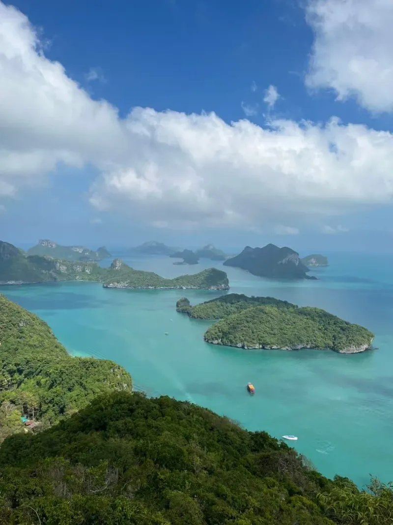
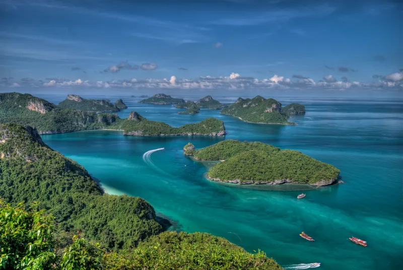
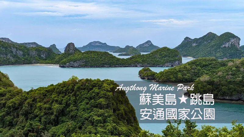
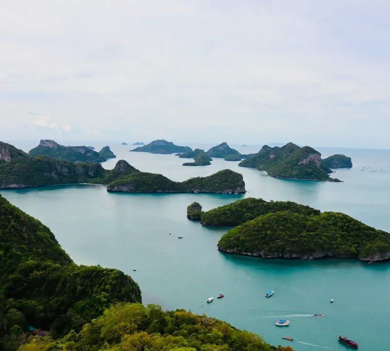
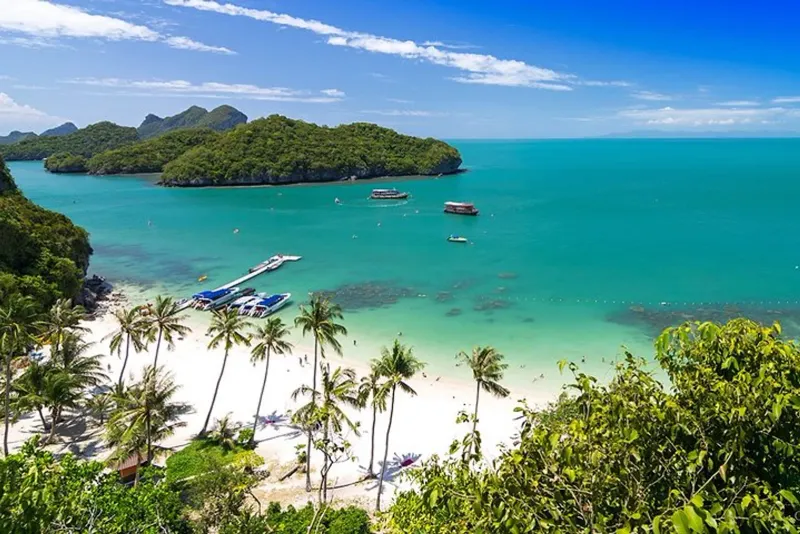
The Ang Thong Wua Talab Viewpoint is the single most rewarding hike accessible from Koh Samui: a steep ~500-step climb on Koh Wua Talab island that opens onto a 360-degree panorama of all 42 islands of Mu Ko Ang Thong National Marine Park. This is a day trip, not a Samui-based trail: the park sits ~30 km northwest of the island in the Gulf of Thailand, reached only by boat from Nathon Pier on Samui’s west coast. Most visitors combine the climb with the park’s other highlights (Bua Bok Cave, the emerald crater lake on Ko Mae Ko, and kayaking among limestone islets) on a single organized tour.
The hike itself is short in distance but hard in effort: loose limestone steps, no shade for long stretches, and a steady 25-45 minute grind to the top. The payoff is one of the most photographed views in Thailand, and it’s why almost every Ang Thong tour itinerary builds in an hour at the park headquarters specifically for this climb.
Key facts: ~500 steps / ~500m to summit · ~30-45 min climb · Difficulty: Hard · ~30 km from Koh Samui · Boat only (~45-60 min speedboat, ~2-3 hr slow boat) · Entrance 300 THB (~8.50 USD) foreign adult · Park hours 8:00 am-5:00 pm · Departs Nathon Pier
The Islands of Ang Thong
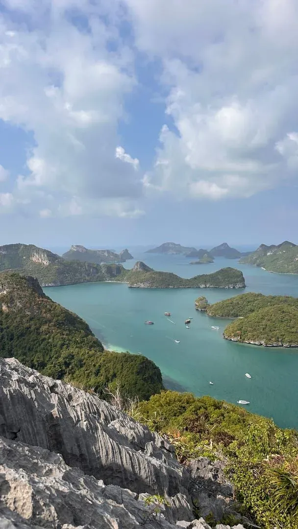
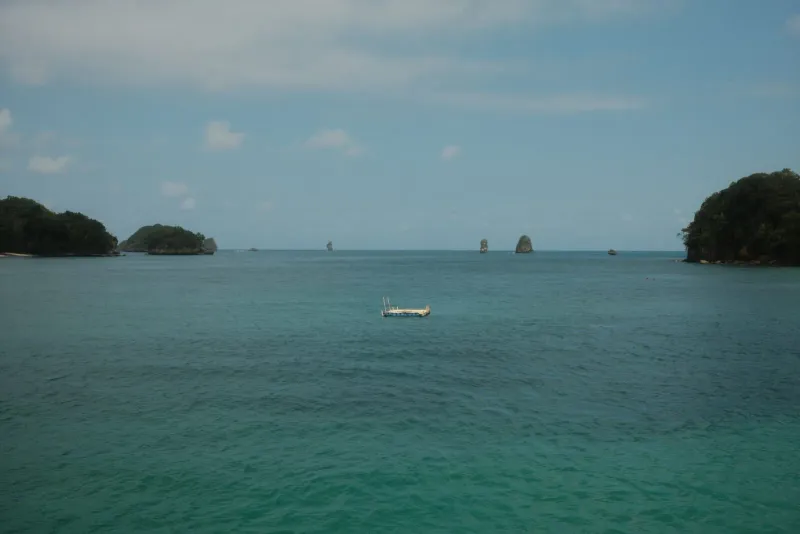
Mu Ko Ang Thong National Marine Park (“Golden Bowl”) covers ~102 km² of the Gulf of Thailand, of which the 42 islands themselves make up only ~18 km²: the rest is protected sea. The park was designated in 1980 and is one of Thailand’s most photogenic marine reserves, built almost entirely from dramatic limestone karst formations rising straight out of turquoise water, similar in geology to Krabi’s Railay and the Phi Phi islands further south.
Koh Wua Talab (“Sleeping Cow Island,” named for its silhouette) is the largest island and hosts the park headquarters, the only visitor bungalows and campground, and the trailhead for the famous viewpoint hike. Other notable islands include Ko Mae Ko, home to the Emerald Lake, and Ko Sam Sao, known for a smaller natural stone arch on its north beach. Because the islands sit outside Koh Samui’s own coastline, a visit to Ang Thong is always a full-day excursion rather than a half-day trail.
Hiking to the Wua Talab Viewpoint
From the park headquarters jetty on Koh Wua Talab, a signed trail climbs directly into the jungle behind the ranger station. The path is a mix of natural stone steps and rocky, root-covered ground: roughly 500 meters and around 500 individual steps to the summit lookout, known locally as Pha Chu Jaras. Rope handrails are bolted in along the steepest sections, but there’s little shade and the limestone gets sharp and slippery when wet, so proper footwear matters more here than on most Samui trails.
Most hikers reach the top in 25-45 minutes, depending on fitness and how often they stop, and you’ll want to stop. Five separate viewpoint clearings are spaced along the route, each opening onto a wider slice of the archipelago, so the climb rewards you well before the summit. Families with young children or anyone with limited mobility often turn back at the ~350-meter viewpoint, which already delivers a strong view of the bay without the final steep push.
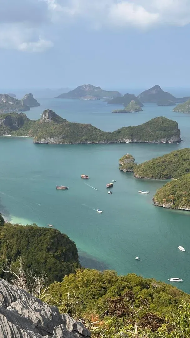
At the top, the trail ends at a small wooden platform wedged between two rock outcrops. From here the view stretches across dozens of the park’s islands scattered through the Gulf like stepping stones: the shot that appears on almost every Ang Thong tour brochure. Sunrise and mid-morning light give the clearest visibility; by tour operators’ own admission, this is usually the single stop every guest photographs the most.
Bua Bok Cave and the Park Headquarters
Back down at sea level, Bua Bok Cave is Koh Wua Talab’s second major attraction, a short walk from the headquarters area. Inside, stalactites and stalagmites have formed one distinctive feature resembling a budding lotus flower, the cave’s namesake (“Bua Bok” translates roughly to lotus bud). Reaching the formations means scrambling over uneven, wet rock in low light, so it’s not a casual stroll; sturdy shoes and a headlamp or phone torch help.
The park headquarters on Koh Wua Talab has a ranger station, basic restrooms, a small restaurant serving simple Thai food, and Ang Thong’s only overnight accommodation: three government bungalows (two sleeping 2 people at 600 THB/night, ~18 USD; one sleeping up to 8 at 1,500 THB/night, ~45 USD, with a ~30% discount Monday-Thursday) plus a campground at 80 THB per person per night (~2.50 USD), with tents rentable for 450 THB (~13.50 USD, up to 3 people). Staying overnight is the only way to see the park without a day-tour crowd, though almost all visitors from Samui do it as a single-day excursion.
Emerald Lake on Ko Mae Ko
A short boat ride from Koh Wua Talab, Ko Mae Ko holds Ang Thong’s other signature sight: Thale Nai, a saltwater lake inside a collapsed limestone crater, connected to the open sea through underwater channels rather than any visible surface link. Its water shifts through vivid green and turquoise tones depending on light and mineral concentration: hence the “Emerald Lake” name.
You can’t swim in the lake itself, but a steep, exposed climb (roughly comparable in effort to a shorter version of the Wua Talab trail) leads to an overlook where you can photograph it from above, ringed by sheer cliffs on all sides. Most day-tour itineraries allocate 20-30 minutes here, usually before or after lunch and before the boat continues to Koh Wua Talab for the main viewpoint hike.
Kayaking and Snorkeling
Beyond the two headline hikes, most full-day Ang Thong tours build in time for kayaking and snorkeling among the smaller islets. Ko Tai Plao is generally rated the best kayaking spot in the park, with low rock overhangs, narrow tunnels, small sea caves, and at least one hidden lagoon accessible only by paddling through a gap in the cliffs at the right tide.
Snorkeling is a secondary draw compared to Koh Tao’s dive sites, but shallow reef patches around several of the smaller islands offer decent visibility outside monsoon season, with reef fish and occasional sightings of blacktip reef sharks in deeper channels. Bring your own mask if you have one: rental gear on group boats is shared and inconsistent in fit.
How to Get to Ang Thong from Koh Samui
Because Ang Thong sits well outside Samui’s own waters, the only way to visit is by boat, and virtually every visitor books an organized tour rather than arranging independent transport. All boats depart from Nathon Pier on Koh Samui’s west coast, generally between 8:00-9:00 am, returning by mid-to-late afternoon.
| Boat type | Travel time (one way) | Typical price |
|---|---|---|
| Big/slow boat | ~2-3 hours | From ~1,000-1,100 THB (~29-31 USD) |
| Speedboat | ~45-60 minutes | From ~2,000 THB (~57 USD) |
| Private charter | ~45-60 minutes | From ~47,000 THB (~1,343 USD) per group |
Most resorts and hotels on Samui and neighboring Koh Phangan offer round-trip hotel transfers to Nathon Pier as part of the tour package: check this is included before booking, since it isn’t always automatic.
Tour Options and Prices
Day tours are sold in three broad tiers, and the choice mostly comes down to how much time you want on the water versus at the sights.
| Tour type | Best for | Approx. price |
|---|---|---|
| Big boat (group) | Budget travelers, families | ~1,000-1,200 THB (~29-34 USD) |
| Speedboat (group) | Less travel time, more sights | ~2,000-2,500 THB (~57-71 USD) |
| Private speedboat charter | Small groups wanting a custom pace | ~47,000 THB+ (~1,415 USD+) per boat |
The 300 THB (~8.50 USD) foreign adult entrance fee (150 THB / ~4.50 USD for children aged 3-14) is charged separately from the tour price at most operators: confirm whether it’s included when you book, since it’s easy to be surprised by it on arrival at Ko Mae Ko or Koh Wua Talab. Thai nationals pay a reduced 40 THB (adults) / 20 THB (children).
Best Time to Visit Ang Thong
| Season | Months | Conditions | Rating |
|---|---|---|---|
| Dry, calm | Feb-Apr | Clearest water, calmest seas, best visibility | ★★★★★ |
| Late dry | May-Sep | Generally calm, occasional afternoon showers | ★★★★ |
| Early monsoon | Oct | Rougher seas, tours sometimes cancelled | ★★ |
| Peak monsoon | Nov-mid Dec | Park typically closed for safety | Closed |
The park’s boat operators typically suspend tours from around November 1 through mid-December each year while the Gulf of Thailand monsoon brings dangerous swell: always confirm current closure dates directly with your tour operator before booking a trip in this window. February through April is the sweet spot: calm crossings, clear water for snorkeling, and the best visibility from the Wua Talab summit.
What to Bring
| Item | Why |
|---|---|
| Closed hiking shoes with grip | Limestone steps on the Wua Talab trail are sharp and slippery: flip-flops are genuinely risky |
| Reusable water bottle (1L+) | No shade on most of the climb; some operators discourage single-use plastic on the islands |
| Swimwear + quick-dry towel | For kayaking, snorkeling, and beach stops |
| Reef-safe sunscreen + hat | Full sun exposure on boats and at the summit |
| Motion sickness tablets | Slow boats can roll in choppy Gulf swell |
| Cash (THB) | Entrance fee and any extras are rarely covered by card on the islands |
Safety and Practical Tips
- The Wua Talab climb is genuinely strenuous in tropical heat and humidity: pace yourself, use the rope handrails on steep sections, and turn back at the ~350m viewpoint if you’re struggling; there’s no shame in skipping the final push.
- Wet rock is the main hazard, both on the summit trail and inside Bua Bok Cave: a light rain can make either section unsafe within minutes.
- Boat crossings can be rough outside the Feb-Sep window; anyone prone to seasickness should medicate before departure, not after symptoms start.
- Bring cash: card payment is unreliable on the islands, and the entrance fee is often collected in person at Ko Mae Ko or the Koh Wua Talab jetty.
- Follow your guide’s schedule: tour boats run tight itineraries to fit the viewpoint hike, Emerald Lake, and kayaking into one day, and stragglers can shorten everyone else’s time at each stop.
- Respect the marine park rules: no removing coral, shells, or rock; no littering; some operators actively ban single-use plastic bottles onboard.
Who Is Ang Thong Best For?
| Traveler Type | Fit | Why |
|---|---|---|
| Adventure seekers | ★★★★★ | The steep 500-step climb and Bua Bok Cave scramble are the most demanding “trail” reachable from Samui |
| Photographers | ★★★★★ | The Wua Talab summit and Emerald Lake overlook are among Thailand’s most photographed viewpoints |
| Families with older kids | ★★★★ | The ~350m halfway viewpoint gives a strong view without the full climb; younger kids may struggle |
| Casual sightseers | ★★★ | Long boat days and a hard climb make this less relaxing than a beach day |
| Snorkelers | ★★★ | Decent reef patches, but not a substitute for a dedicated Koh Tao dive trip |
| Budget travelers | ★★★★ | Big-boat group tours from ~1,050 THB (~30 USD) keep this one of the cheaper full-day excursions from Samui |
FAQ
How many steps is the Wua Talab Viewpoint hike?
Roughly ~500 steps over about 500 meters of trail, climbing steadily from the Koh Wua Talab park headquarters to the summit lookout. Most visitors reach the top in 25-45 minutes. Rope handrails assist on the steepest sections, and five viewpoint clearings along the way let you rest and take in progressively wider views of Ang Thong’s 42 islands.
Is Ang Thong Marine Park a day trip from Koh Samui?
Yes: Ang Thong sits ~30 km northwest of Koh Samui and can only be reached by boat, so it’s always a full-day excursion, not a Samui-based hike. Boats depart from Nathon Pier around 8:00-9:00 am and return in the late afternoon, typically combining the Wua Talab viewpoint hike with Bua Bok Cave, the Emerald Lake, and kayaking.
How much does it cost to visit Ang Thong National Marine Park?
Tour prices start around 1,000-1,200 THB (~29-34 USD) for a big-boat group tour and 2,000-2,500 THB (~57-71 USD) for a speedboat. The park’s own entrance fee is separate: 300 THB (~8.50 USD) for foreign adults and 150 THB (~4.50 USD) for children, usually collected on-site at Ko Mae Ko or Koh Wua Talab.
Is the Wua Talab hike difficult?
Yes: it’s rated Hard on our scale. The ~500-step climb is steep, exposed to sun for long stretches, and covers sharp, sometimes slippery limestone. Sturdy closed shoes are essential. Families or less mobile visitors often stop at the ~350-meter viewpoint, which still offers strong views without the final steep section.
When is Ang Thong Marine Park closed?
The park typically suspends tours from around November 1 through mid-December each year due to monsoon swell in the Gulf of Thailand, though exact dates shift annually with conditions. February through April brings the calmest seas and clearest water, making it the best overall window to visit.
Can I stay overnight at Ang Thong?
Yes, but only on Koh Wua Talab at the park headquarters. Three government bungalows are available (600 THB/night for 2-person units, ~18 USD; 1,500 THB/night for an 8-person unit, ~45 USD), plus camping at 80 THB per person (~2.50 USD) with tent rental at 450 THB (~13 USD). Almost all Samui visitors do Ang Thong as a single-day tour instead.
For more of Samui’s toughest climbs, see the Na Muang Waterfalls Trail and the Khao Pom viewpoint hike, or unwind afterward at Lipa Noi Beach or Taling Ngam Beach, both a short drive from the Nathon Pier boats that leave for Ang Thong each morning. For background on the park’s geology and protected status, see Mu Ko Ang Thong National Park on Wikipedia and the ranger-station overview at ThaiNationalParks.com.
Published Updated
About the author

Mike Brochlowski
Travel photographer & writer
Travel photographer and island explorer. Mike has spent years documenting Southeast Asia's hidden gems, from secluded beaches to jungle waterfalls.
Articles by Mike →More in Hiking
28 km away
Laem Yai Viewpoint: Koh Samui's Free West-Coast Sunset Hill
Laem Yai Viewpoint is a free roadside hill lookout on Koh Samui's northwest headland, opposite the Four Seasons entrance, facing west for…
29 km away
Thong Plu Beach: Koh Samui's Quiet Northwest Corner
Thong Plu Beach is an isolated, very shallow stretch on Koh Samui's northwest edge: laid-back, undeveloped, and rarely visited by tourists.
Next in Hiking
Maenam to Magic Garden Traverse: Koh Samui's Grand Ridge Hike
Hike ~10 km across Koh Samui's mountain spine from Maenam Viewpoint (420m) to the Secret Buddha Garden, a hard 3-4 hour jungle traverse.