Contents
Overview
The Grand Viewpoint Traverse is the longest connected hiking route in Koh Samui’s central highlands: a ~10.2 km trek that strings together the island’s best highland scenery in a single day. Starting near Khun Si Waterfall above Bophut, the route climbs through durian plantations and jungle ridgeline to a string of panoramic viewpoints before finishing at a mountain-top restaurant with 360-degree views. Budget ~4 hours and ~586 meters of cumulative elevation gain for the full traverse.
Unlike the short, single-destination trails elsewhere on the island, this route is built for hikers who want the complete highland experience in one outing: waterfall pools, ridge viewpoints over the Gulf of Thailand and Koh Phangan, and a proper sit-down meal at the top rather than a packed lunch on a rock. It shares its trailhead with the well-known Khun Si Waterfall Trail, so many hikers combine a swim at the falls with the longer traverse above it.
Trail at a Glance: ~10.2 km one-way/loop combination · ~586 m elevation gain · ~4 hours · Moderate difficulty · Links Khun Si Waterfall, 2+ viewpoints, and a mountain restaurant · Trailhead parking ~50 THB (~1.50 USD)
Trail Details
| Stat | Detail |
|---|---|
| Total distance | ~10.2 km (combination of ridge singletrack and access tracks) |
| Elevation gain | ~586 meters (~1,923 feet) cumulative |
| Time | ~4 hours at a steady pace, including stops at viewpoints |
| Difficulty | Moderate: steady climbing, no technical scrambling |
| Trail type | Point-to-point / loop combination, shared trailhead with Khun Si |
| Markings | Inconsistent between viewpoints: GPS track recommended |
| Water sources | None reliable on trail: carry all you need |
| Best months | November through April |
For comparison, local hikers on AllTrails rate the shorter Khun Si Waterfall - Samui Viewpoint loop as a “hard” 4-4.5 hour outing on its own, so treat the ~586 m figure for the full Grand Viewpoint Traverse as a genuine highland workout rather than a casual stroll.
The Route: Khun Si Waterfall to the Highlands
Starting point
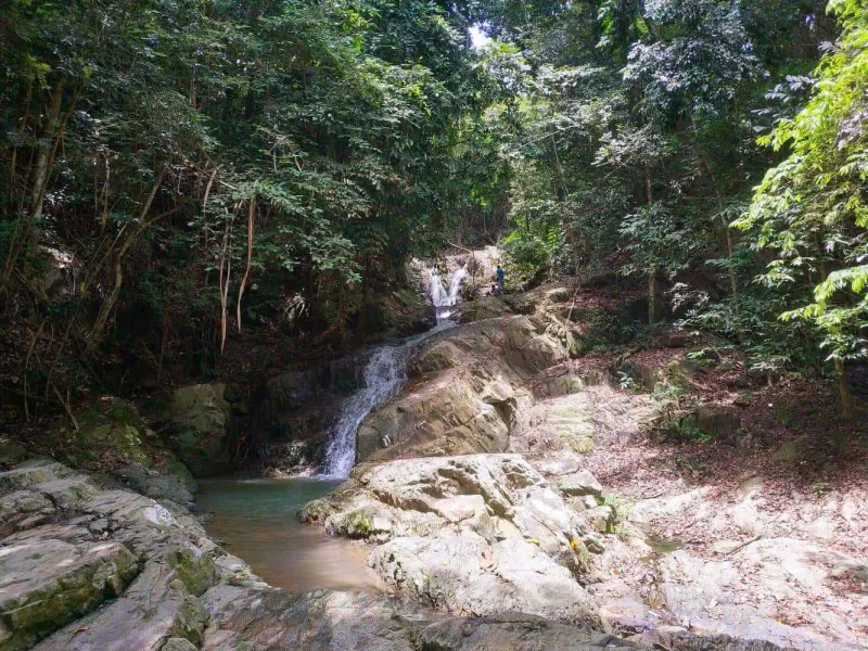
The traverse begins at the same trailhead as the Khun Si Waterfall Trail, tucked into the central highlands directly above Bophut off Route 4169. Many hikers start their day with the short, steep descent to Khun Si Waterfall itself (a series of tiered natural pools set among durian and mangosteen plantations) before turning uphill for the longer traverse.
Climbing to the ridge
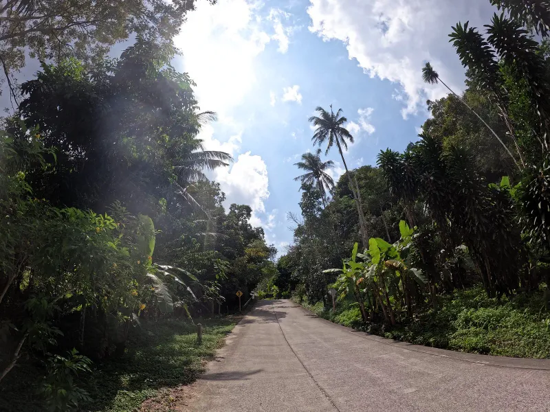
From the waterfall access track, the trail switches direction and climbs steadily through plantation land and secondary jungle. The gradient is consistent rather than punishing: no scrambling is required, but the humidity and lack of shade in places make the climb feel harder than the numbers suggest.
The long ridge section
Once on the main ridgeline, the trail rolls along the spine of the central highlands for several kilometers, weaving between patches of forest and open, grassy sections that deliver the first big views back down toward Bophut and the north coast.
Viewpoints Along the Way
The defining feature of this route is that it doesn’t stop at a single lookout: it chains several together.
Khun Si Viewpoint
A short detour near the start of the climb leads to the Khun Si Viewpoint, a panoramic lookout over Bophut’s lush hills and the coastline below. It’s a popular spot for sunrise and sunset photography, when the sky over the Gulf of Thailand turns shades of orange and pink.
Cocoon-style hilltop lookouts
Further along the ridge, the trail passes near the hilltop terraces made famous by Bophut’s cliffside viewpoint cafés (open-air platforms perched above the treeline with views stretching across the Gulf of Thailand toward Koh Phangan on a clear day). These commercial viewpoints (some, like the well-known Cocoon-style cafés, charge nothing for the view itself but expect a food or drink order) make a good rest stop roughly a third of the way through the traverse.
The final approach
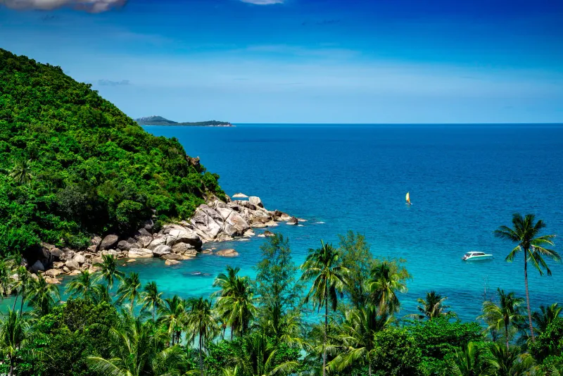
The last viewpoint before the mountain restaurant is the highest of the route, giving a genuine 360-degree perspective: Chaweng and Choeng Mon to the east, Nathon and the west coast in the distance, and on the clearest days the outline of the Ang Thong Marine National Park islands offshore.
Jungle Route 360: The Mountain Restaurant
The traverse’s centerpiece is a proper meal stop at a restaurant perched on one of Koh Samui’s second-highest peaks, roughly the two-thirds mark of the route. Modeled on spots like the island’s well-known Jungle Route 360, these mountain restaurants combine a 360-degree panoramic dining terrace with simple Thai food (think tom yum, fried rice, and fresh fruit shakes) at prices around 150-300 THB (~4.50-8.50 USD) per dish. Many also offer a small swimming pool for a fee of roughly 100 THB (~3 USD), a welcome reward after the climb.
Practical note: these mountain restaurants typically open around 8:00 AM and close by 5:00 PM, so time your hike to arrive for a late lunch rather than dinner: there’s no safe way down after dark without a headlamp.
Terrain and Trail Conditions
The Grand Viewpoint Traverse mixes several terrain types, which is part of what makes it more demanding than a single-destination waterfall hike:
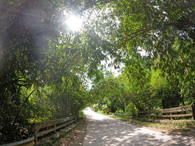
- Plantation tracks: packed dirt, easy footing, shaded by durian and mangosteen trees
- Ridge singletrack: narrow dirt path, occasional exposed roots, generally dry underfoot outside the wet season
- Open grassy sections: full sun exposure, can be slippery when wet, best tackled early
- Access roads near the restaurant: packed laterite, occasionally used by staff scooters
None of the terrain requires ropes or technical scrambling, unlike the via ferrata sections on the Na Muang Waterfalls Trail, but the cumulative distance and heat make this a genuine full-day commitment rather than a quick outing.
Wildlife and Jungle Scenery
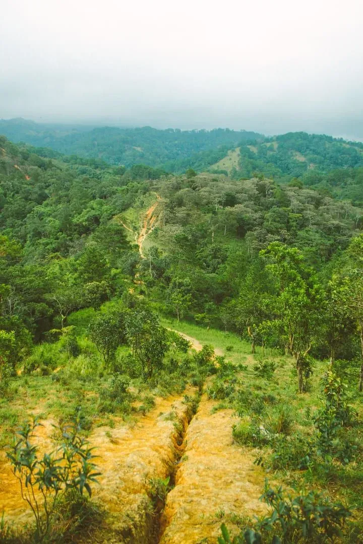
The central highlands above Bophut hold pockets of secondary and, in places, near-primary forest that support a reasonable range of wildlife for an island this size.
- Dusky langurs: occasionally spotted in the canopy near the ridge, especially early morning
- Monitor lizards: sunning themselves on open rock sections
- Butterflies and dragonflies: abundant near any damp gullies crossed by the trail
- Hornbills and sunbirds: heard more often than seen in the denser plantation sections
- Durian and mangosteen orchards: working plantations rather than wild jungle, but a distinctive part of the landscape in the lower third of the route
Getting There
Location
The trailhead sits in the central highlands directly above Bophut, reached via a signed turnoff from Route 4169. It shares its access point with the Khun Si Waterfall parking area.
From different areas
| Starting Point | Drive Time | Taxi Cost (approx.) |
|---|---|---|
| Bophut / Fisherman’s Village | 15-20 min | 200-350 THB (~5.50-10 USD) |
| Chaweng | 20-25 min | 350-500 THB (~10-14 USD) |
| Maenam | 20-25 min | 300-450 THB (~8.50-13 USD) |
| Nathon | 30-35 min | 500-700 THB (~14-20 USD) |
Transport
- Scooter: The cheapest and most flexible option. Basic models rent from ~150 THB/day, with mid-range scooters around 250 THB/day. Follow signs off Route 4169 toward Khun Si.
- Taxi: No meters on Samui. Negotiate the fare before departure, and arrange a pickup time at the restaurant end of the route if doing it point-to-point.
- Guided hikes: Some local operators run guided highland trekking days that include this route plus lunch at the mountain restaurant.
Parking
A small lot at the Khun Si trailhead charges roughly 50 THB (~1.4 USD) for cars and motorbikes.
Best Time to Hike
| Season | Months | Trail Conditions | Views | Rating |
|---|---|---|---|---|
| Dry season | Dec-Apr | Firm footing, dusty in places | Clearest, especially Dec-Feb | ★★★★★ |
| Early wet season | May-Jul | Occasional afternoon showers | Lush and green, hazier | ★★★★ |
| Peak monsoon | Oct-Nov | Slippery ridge sections, flash flood risk near the waterfall | Reduced visibility | ★★ |
| Transition | Aug-Sep | Variable, check forecasts | Moderate | ★★★ |
Best time of day: Start by 7:00-8:00 AM to reach the mountain restaurant for lunch, avoid the worst of the midday heat on the exposed ridge sections, and leave a comfortable buffer before the restaurant closes at 5:00 PM.
What to Bring
| Item | Why |
|---|---|
| Hiking shoes with grip | Ridge sections get slippery in the wet; sandals are not enough |
| 2L+ of water | No reliable water sources on the trail itself |
| Sun protection | Long exposed ridge and grassy sections with little shade |
| Cash (small bills) | Parking fee, viewpoint cafés, and the mountain restaurant are cash-based |
| Insect repellent | Plantation sections hold mosquitoes year-round |
| Power bank / offline map | Poor trail markings between viewpoints make GPS essential |
Safety
- Heat and hydration: The exposed ridge and grassy sections offer little shade at midday. This is the biggest real risk on the route, more than terrain.
- Navigation: Trail markings between viewpoints are inconsistent. Download an offline GPS track before starting; do not rely on phone signal alone.
- Timing: There is no lighting on any section of this trail. Plan to be off the ridge well before dusk.
- Weather: Avoid starting during or right after heavy rain. The ridge sections become slick, and the descent to Khun Si Waterfall can flood quickly.
- Solo hiking: Possible on the well-trodden lower sections, but tell someone your planned route and expected return time given the length of the traverse.
- Group size: This is not a technical trail, but its length means a twisted ankle far from the trailhead is a bigger problem than on the island’s shorter hikes, so hiking with at least one other person is recommended.
Who Is This Trail Best For?
| Hiker Type | Fit | Why |
|---|---|---|
| Fitness hikers | ★★★★★ | ~10.2 km and ~586 m gain is a genuine half-day workout |
| Photographers | ★★★★★ | Multiple distinct viewpoints in one outing, plus golden-hour ridge light |
| Foodies | ★★★★ | The mountain restaurant stop is a genuine highlight, not an afterthought |
| Waterfall lovers | ★★★★ | Easy to combine with a swim at Khun Si Waterfall before or after |
| Families with young kids | ★★ | Distance and heat make this unsuitable for small children |
| First-time hikers on Samui | ★★★ | Better suited to fitter beginners; start with Khun Si alone if unsure |
| Budget travelers | ★★★★ | Low parking fee; only real cost is food at the restaurant |
FAQ
How long is the Grand Viewpoint Traverse?
The full route covers ~10.2 km with ~586 meters of cumulative elevation gain, taking around 4 hours at a steady hiking pace including stops at viewpoints and lunch. It shares its trailhead with the shorter Khun Si Waterfall Trail, so hikers pressed for time can shorten the day by skipping the upper ridge sections.
Can I combine this hike with Khun Si Waterfall?
Yes: the traverse starts at the same trailhead as the Khun Si Waterfall Trail. Most hikers add a short detour down to the waterfall’s tiered swimming pools before or after tackling the longer ridge route, making for a full and varied highland day.
Is there food and water on the trail?
There is no reliable water source on the trail itself, so carry at least 2 liters. Food is available at the mountain restaurant near the two-thirds mark, with simple Thai dishes priced around 150-300 THB (~4.50-8.50 USD), plus small viewpoint cafés passed earlier on the route.
Do I need a guide for the Grand Viewpoint Traverse?
A guide isn’t mandatory, but trail markings between viewpoints are inconsistent, so downloading an offline GPS track is strongly recommended. Guided highland trekking tours are available locally and typically include the mountain restaurant lunch stop.
What’s the best time of year to hike?
December through April offers the firmest footing and clearest long-distance views toward Koh Phangan and the Ang Thong islands. Avoid starting during or immediately after heavy rain in the October-November monsoon peak, when the exposed ridge sections become slippery.
Is the Grand Viewpoint Traverse suitable for beginners?
It’s rated moderate rather than technical, but the ~10.2 km distance and heat make it more demanding than most Samui day hikes. First-time hikers on the island in reasonable fitness can manage it, but true beginners may prefer starting with the shorter Khun Si Waterfall Trail alone.

Published Updated
About the author

Migues Ferfumoz
Writer, Koh Samui resident since 2019
Freelance writer and Koh Samui resident since 2019. Migues covers local culture, food, and the best off-the-beaten-path destinations on the island.
Articles by Migues →More in Hiking
2.5 km away
Wat Teepangkorn, Koh Samui: 635 m Summit and Standing Buddha
Wat Teepangkorn is the temple on Koh Samui's highest point (635 m): a golden standing Buddha, museum and 360-degree views.
2.8 km away
The Roof Samui: Reviews, 4x4 Shuttle and Hilltop Views
The Roof Samui is a hilltop restaurant above Chaweng Noi, open 11:00-22:00 with a 4x4 shuttle (about 50 THB).
Next in Hiking
Lardwanorn Waterfall Loop: Samui's Hidden West Coast Secret
Explore the Lardwanorn Waterfall Loop (Lat Wanon) on Koh Samui.