Contents
Overview
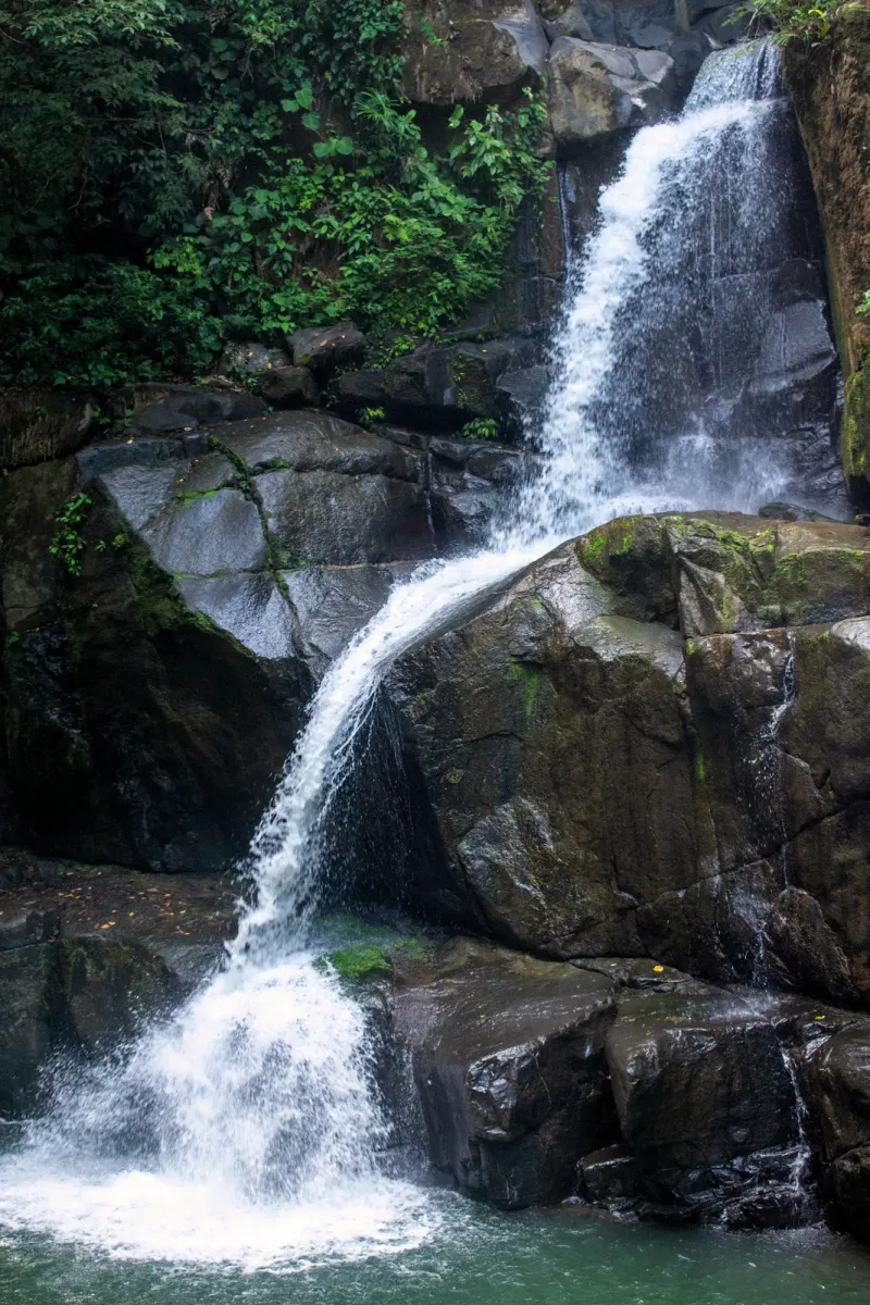
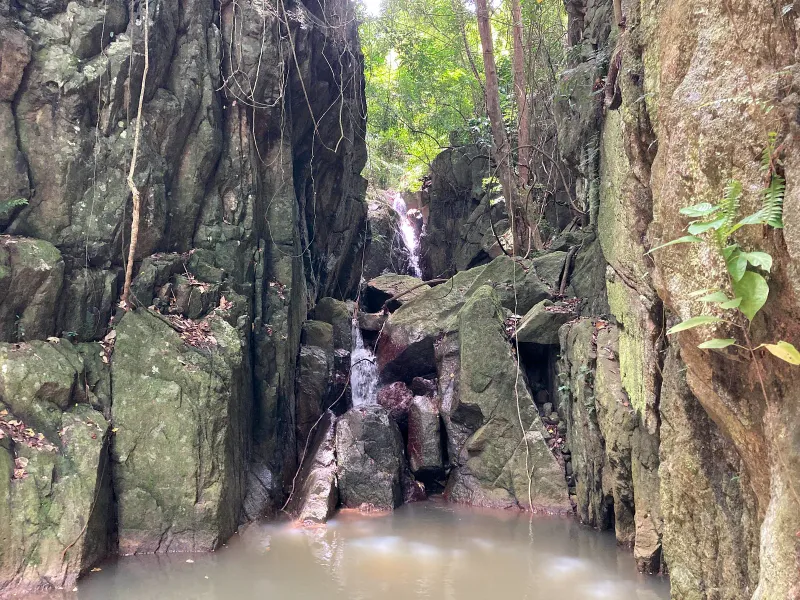
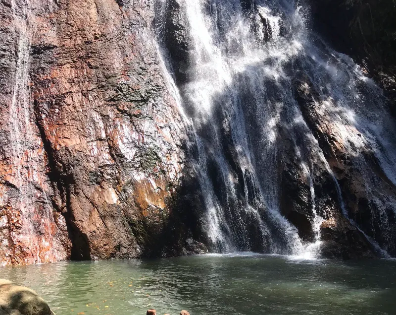
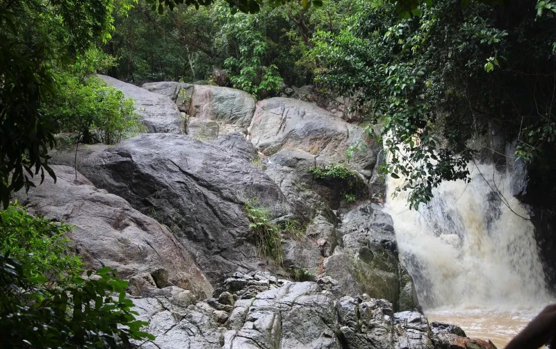
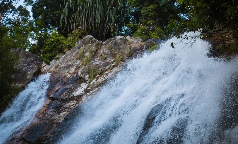
Lardwanorn Waterfall (also frequently spelled Lat Wanon) is one of Koh Samui’s most authentic “hidden gems.” Tucked away on the island’s tranquil west coast near Lipa Noi, it offers a stark contrast to the highly commercialized Na Muang falls. This isn’t just a single drop; it’s a sprawling, multi-tiered complex of rock formations and gentle cascades that flow through dense, primary jungle and local plantations, with each level offering its own small pool and its own patch of shade.
The Lardwanorn loop is perfect for those who seek solitude and a raw connection with nature. Unlike the east coast attractions, you won’t find souvenir stalls or paved walkways here. Instead, you’ll find a rugged trail that rewards adventurous hikers with cooling natural pools and spectacular views of the Gulf of Thailand from its higher elevations.
The trailhead is roughly 3.8 km south of Nathon and about 6 km north of Lipa Noi Beach, putting it within a 10-15 minute scooter ride of either town. The full 2.5 km loop climbs around 100 metres from the coastal plain into the hills, and because the going is easy at the bottom and only gets technical near the top, it works well as either a quick 30-minute dip at Level 1 or a full 1.5-hour exploration all the way to the viewpoint.
Trail at a Glance:
- Distance: ~2.5 km (full loop exploration)
- Duration: 1 - 1.5 hours
- Difficulty: Easy to Moderate
- Highlights: Tiered cascades, panoramic views, jungle solitude
- Entry Fee: Free (occasional 20-30 THB parking fee)
Trail Details: What to Expect
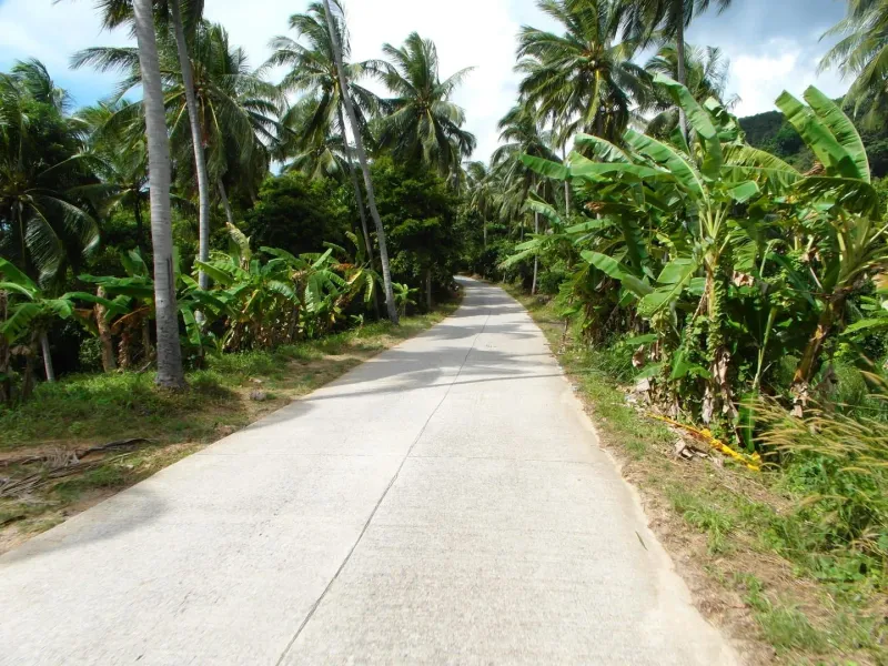
The experience at Lardwanorn begins even before you reach the water. The entrance path takes you through a working landscape of coconut and banana plantations, providing a glimpse into the agricultural life of Samui that existed long before tourism.
The Initial Path
The first 10 minutes of the trail are relatively flat and easy. The path follows the natural line of the stream, shaded by a canopy of diverse tropical trees. This section is suitable for almost everyone, including older children and grandparents with reasonable mobility, and leads directly to the first few levels of the waterfall.
The Jungle Incline
As you push beyond the first level, the trail becomes more distinctively a “hike.” The terrain shifts to a mix of dirt paths and rocky scrambles. You will need to navigate around massive granite boulders and use tree roots as natural steps. The air here is noticeably cooler than on the coast, though the humidity of the dense jungle remains high.
Flora and Wildlife
The lower plantation section is dominated by coconut palms and banana plants tended by local families, while the upper jungle transitions into denser secondary forest with rattan, wild ginger, and towering dipterocarp trees. Skinks and monitor lizards are common on the sun-warmed boulders near the pools, and the tree canopy hosts bulbuls, sunbirds, and the occasional troop of long-tailed macaques moving through the branches: keep food packed away, as macaques will investigate an open bag left unattended. Leeches can appear in the leaf litter during the wettest months (October-December); a quick ankle check after the muddy sections is worth the ten seconds it takes.
Exploring the Tiers
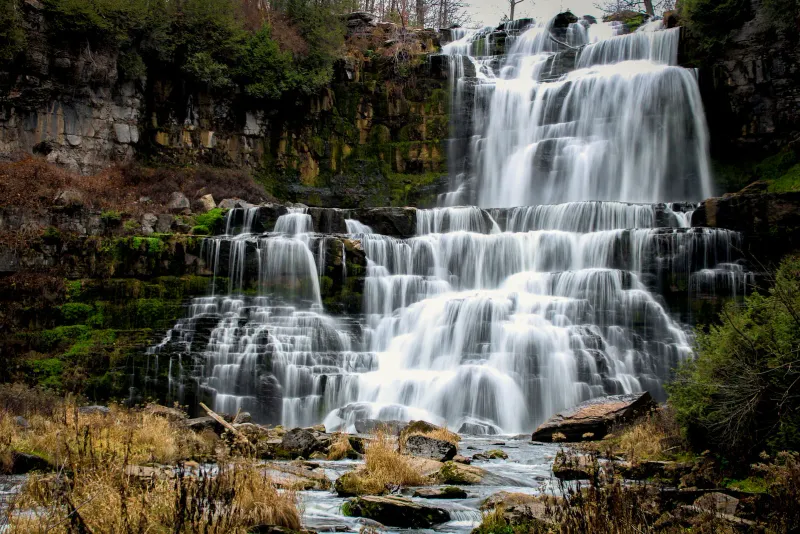
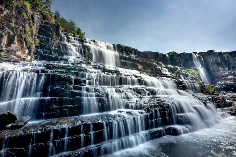
Lardwanorn is unique because its “waterfall” is actually a long series of stepped rock formations.
- Level 1-2: These are the most accessible areas, reachable in the first 10 minutes from the entrance. The water here forms shallow pools that are ideal for families with children or those just looking to splash their feet, and the flat granite ledges make a comfortable spot to lay out a picnic.
- The Upper Tiers: To reach the higher levels, you’ll need to follow the trail upward for another 20-30 minutes. This section requires sturdy footwear as the rocks can be extremely slippery, especially after a rain shower. Each tier is separated by a short scramble over water-smoothed boulders, so plan on stopping to check footing rather than moving continuously.
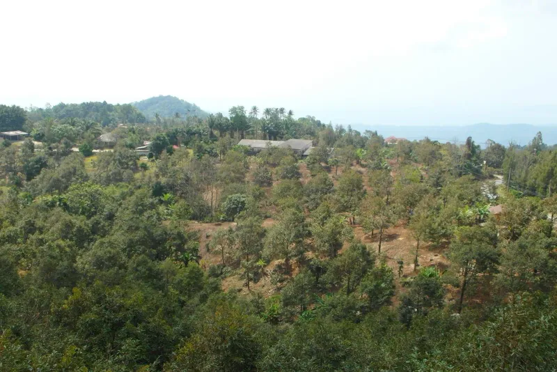
- The Viewpoint: At the very top of the trail, the jungle opens up to reveal a stunning panoramic view. On a clear day, you can see all the way to the mainland and the distant islands of the Ang Thong Marine Park.
The stream that feeds all of Lardwanorn’s tiers drains off the same central highlands that feed Khun Si and Na Muang, which is why all three respond to rainfall on roughly the same schedule. Pool depth varies by level: the lower, family-friendly pools rarely exceed 40-50 cm, while a couple of the mid-loop basins deepen to around 1 metre after sustained rain, always shallow enough to wade rather than dive. Water temperature sits around 25°C year-round, a couple of degrees cooler than the sea at Lipa Noi.
Difficulty & Duration
| Section | Time | Difficulty | Terrain |
|---|---|---|---|
| Entrance to Level 1 | 10 min | Easy | Flat dirt path |
| Level 1 to Upper Tiers | 20-30 min | Moderate | Steep, rocky, roots |
| Full Loop Exploration | 1.5 hours | Moderate | Varied |
The Lardwanorn loop is rated as Easy to Moderate. While the distance is short, the vertical gain and the technical nature of the rocky sections in the upper tiers mean it requires a basic level of fitness and balance.
Compared with the west coast’s other big trail, the Grand Viewpoint Traverse, Lardwanorn is far shorter and more forgiving, a good warm-up hike before attempting something longer later in your trip. Most visitors in reasonable shape complete the full loop, swim breaks included, in under two hours.
Getting There
Lardwanorn is located off the main Route 4169 ring road on the west side of the island, approximately 3.8 km south of Nathon.
- Look for the Sign: Watch for a small, slightly weathered sign that says “Wanrorn Waterfall” or “Lat Wanon” near the junction for Lipa Noi Beach.
- The Access Road: Follow the narrow concrete road inland for about 1.5 km. You will pass local houses and plantations.
- Parking: The road ends at a small dirt clearing where you can park your scooter or car. Locals may sometimes collect a small fee (20-30 THB) for parking and maintenance.
Any scooter can manage the access road, since it’s paved concrete rather than the steep dirt tracks found at some of the island’s mountain trails. From Nathon’s ferry pier, allow about 10 minutes by scooter or a 15-minute Grab ride; from Chaweng on the east coast, the crossing takes closer to 40-45 minutes via the ring road. If you’re arriving by ferry from Surat Thani or Don Sak, Nathon Pier is the closest jumping-off point, and renting a scooter there for the day is usually cheaper than a return taxi.
Best Time to Visit
Timing is critical for Lardwanorn, as it is a highly seasonal waterfall that depends entirely on recent rainfall rather than a year-round spring source.
| Season | Months | Rating | Condition |
|---|---|---|---|
| Monsoon | Oct - Dec | ★★★★★ | Peak flow; very lush; can be slippery. |
| Post-Rain | Jan - Feb | ★★★★ | Great flow; safer trails; clear skies. |
| Hot/Dry | Mar - June | ★★ | Waterfall may be a trickle; pools dry up. |
| Intermittent | July - Sept | ★★★ | Flow depends on weekly rainfall. |
Pro Tip: Visit in the early morning (before 10:00 AM) to avoid the heat and have the highest chance of having the entire waterfall to yourself.
Because Lardwanorn depends entirely on rainfall rather than a spring-fed source, checking recent weather is more useful here than checking a calendar date. A few consecutive dry days in the supposedly wet month of November can leave the upper tiers running thin, while a late storm in April can briefly refill the pools out of season. When in doubt, ask your accommodation or a local scooter-rental shop whether the falls have had recent flow: they usually know before any website does.
Practical Tips
- Footwear: Sturdy hiking sandals or sneakers are essential. Do not attempt the upper tiers in flip-flops.
- Insect Repellent: The shaded jungle environment is a haven for mosquitoes. Apply repellent before you start the hike, and reapply after any swim since most sprays wash off.
- Water: Bring at least 1 liter of water per person. There are no vendors once you leave the parking area.
- Safety: Tell someone where you are going. While the trail is straightforward, it is remote, and phone signal can be spotty at the higher levels.
- Respect Nature: This is a pristine area. Carry out all trash and avoid using soap or shampoo in the natural pools.
- Cash for Parking: Keep 20-50 THB (~0.50-1.50 USD) in small notes on hand in case a local caretaker is collecting the parking fee that day.
- Start Early: Combine the hike with sunset at Lipa Noi Beach afterward: the west coast’s flat horizon makes it one of the island’s best sunset spots.
Nearby Attractions
Lardwanorn sits close to several other west-coast highlights, all within a 15-20 minute ride:
- Lat Wanon Waterfall: the standalone waterfall entry with more photos and detail on the cascade itself.
- Lipa Noi Beach: the island’s best sunset coast, a few minutes south of the trailhead.
- Na Muang Waterfalls: Samui’s largest and most famous falls, for a direct comparison with this quieter alternative.
- Ang Thong Marine Park: the 42-island archipelago visible from the loop’s upper viewpoint, reachable by boat tour from Nathon.
For a wider view of the island’s trail network, see the Koh Samui Waterfalls & Hiking guide, ranked by season and difficulty.
Who Is It Best For?
| Traveler Type | Suitability | Why? |
|---|---|---|
| Solo Explorers | ★★★★★ | Perfect for those seeking peace and quiet. |
| Nature Photographers | ★★★★★ | Incredible mossy textures and jungle light. |
| Families | ★★★ | Good for older kids; lower levels are safe for toddlers. |
| Luxury Seekers | ★ | Too rugged and lacks commercial facilities. |
FAQ
Is Lardwanorn Waterfall free to visit? Yes, there is no official entrance fee. However, you should bring some small change (20-50 THB, roughly 1-1.50 USD) in case a local land owner asks for a small parking fee or if you want to support the maintenance of the trail.
Can you swim at Lardwanorn? Yes, but the pools are generally shallow. They are better for wading and cooling off than for serious swimming. During the rainy season, the pools are deeper and more inviting, occasionally reaching close to a metre at the mid-loop basins.
Do I need a guide for this trail? No, a guide is not necessary. The path is relatively intuitive as it follows the riverbed. However, if you are not an experienced hiker, it is always safer to go with a partner, and worth telling your accommodation which trail you’re taking before you set off.
How does it compare to Na Muang? Na Muang is much larger and more spectacular in terms of height, but it is also very crowded and commercial, with paved paths and an entrance fee. Lardwanorn is smaller but offers a much more peaceful, “raw” nature experience, free of charge.
Is it safe for children? The lower levels are very safe and easy to reach. The upper tiers involve steep climbing and slippery rocks, which may be too challenging for younger children or those without proper footwear.
What should I pack for the Lardwanorn hike? Sturdy sandals or trail shoes, at least 1 litre of water per person, insect repellent, and small cash (20-50 THB) for a possible parking fee. A dry bag is worth carrying if you plan to swim at the mid-loop pools.
How does Lardwanorn compare to Samui’s east coast trails? Most east coast trails (like Hin Lad Waterfall Trail near Nathon) are set up for higher foot traffic, with clearer signage and more visitors. Lardwanorn’s west coast location keeps crowds low, but it also means fewer facilities and a greater reliance on your own navigation and preparation.
Published
About the author
Samui69 Editorial Team
Editorial team
Guides researched and fact-checked by the Samui69 editorial team: residents and frequent visitors who verify opening hours, prices and directions on the ground.
About the author →More in Hiking
1.6 km away
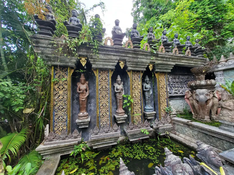
Dusit Dhewa, Lipa Noi: Koh Samui's Southeast Asian Art Park
Dusit Dhewa is a Southeast Asian sculpture and art park in Lipa Noi, Koh Samui: 8 rai of galleries, gardens and carvings, entry roughly 1…
2.3 km away
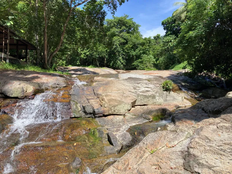
Lat Wanon Waterfall: The Secluded Boulder Rapids of Lipa Noi
Discover Lat Wanon Waterfall on Koh Samui.
Next in Hiking
Wang Sao Thong Trail: Koh Samui's Easiest Waterfall Walk
Walk the Wang Sao Thong Trail on Koh Samui, an easy ~1 km forest path near Hua Thanon leading to a quiet two-tier jungle waterfall in 8-1…